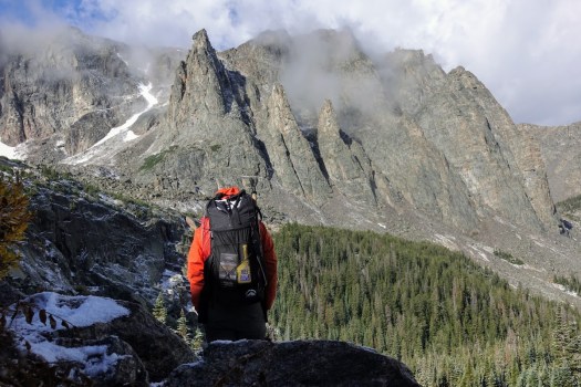
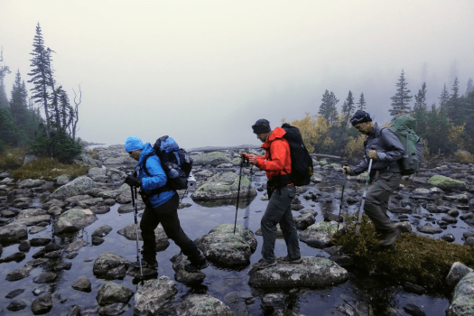
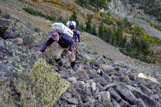
Absaroka-Beartooth Wilderness, Montana

Ryan Jordan:

As part of the Backpacking Light Wilderness Adventures program, Trek Director Kevin Fletcher and I led a guided trip across the Absaroka-Beartooth Wilderness in Montana in September 2018.

This program, dubbed the “Whitetail Trek”, was a new program for us where we gave the group a start and end point and let them plan their own trek across the range. …

WILDERNESS ADVENTURES 2018 WHITETAIL TREK (PHOTO ESSAY)

That was 2018. But a similar off trail route is planned for 2019.

September 21-28, 2019 – WHITETAIL ITINERARY ($1897) – Level 3+ – A longer-duration program (8-day program) spanning a longer traverse of the Beartooth Plateau, with significant off-trail travel.

Patagonia donates Trump tax cut to ENVIRONMENTAL groups

Outdoor retailer Patagonia announced Wednesday that it plans to donate the $10 million it is saving from President Trump’s corporate tax cuts this year to environmental groups.

“Based on last year’s irresponsible tax cut, Patagonia will owe less in taxes this year — $10 million less, in fact,” CEO Rose Marcario wrote in a LinkedIn post Wednesday afternoon.

“Instead of putting the money back into our business, we’re responding by putting $10 million back into the planet. Our home planet needs it more than we do.” …

Patagonia calls Trump tax cut ‘irresponsible,’ says it will donate $10M corporate tax cut to environmental groups

SUPPORT Patagonia if you love the outdoors.

related – Patagonia closing stores nationwide on Election Day

modest National Park proposals

In the era where Trump and his appointee Zinke are happy to sell off protected public lands, these proposals from Backpacker magazine might not seem modest to all.

Casey Lyons – Make More National Parks

M. John Fayhee – Let the National Parks Go Wild

Rachel Zurer – Make the National Parks Free

Hansjörg Wyss – $1 billion for conservation

Wyss Foundation is launching a $1 billion campaign, called the Wyss Campaign for Nature.

The campaign’s goal is to help conserve 30% of the planet in a natural state by the year 2030 by creating and expanding protected areas, establishing more ambitious international conservation targets, investing in science, and inspiring conservation action around the world.

Only by dramatically increasing the capacity of communities, indigenous peoples, and nations to conserve lands, waters, and wildlife can we hope to safeguard the natural world upon which we all depend. …

For example, the Wyss Foundation is providing up to $22 million to help Fundación Flora y Fauna acquire lands to formally establish the Aconquija National Park in Argentina’s Tucumán Province.

Born in Bern, Switzerland, Hansjörg Wyss lives in Wilson, Wyoming.

related – Wyoming billionaire pledges to protect 30% of the planet by 2030

NEW – Annapurna Seven Passes route

I’ve twice been on the Annapurna Circuit. It has been degraded by road building. In fact, on the more recent trip I enjoyed mountain biking more than hiking.

Tripple P. Gurung decided to invent an alternative in the region.

The Annapurna Seven Passes … is a 20-day trek that takes a trekker through seven high passes, four of which are above 5,000 meters. In addition to the challenge of the high passes, this trek offers a mix of wilderness and culture that is missing from treks that run through villages. …

Click PLAY or watch it on YouTube.

It’s actually a route, not a trail. I would need a guide.

QUICK FACTS

  • Difficulty Level
    Hard
  • Total Length
    177 Km
  • Highest Altitude
    5416 Meters
  • Start location
    Tal (1,665m)
  • Finish location
    Jomsom (2,740m)
  • Permits
    ACAP Permit,TIMS Permit,Naar-Phu Restricted Area Permit
  • Best Season
    April-November

Click through for details:

Saving the Annapurna Circuit – The Annapurna Seven Passes Trek

Skurka is writing a book on the new Yosemite High Route

He hopes to publish February 2019 to get the information out for next season.

As Skurka has envisioned it, the YHR forms a figure-eight from Dorothy Lake Pass in the north, pinching in the middle at Tuolomne Meadows, and extending as far south as the area surrounding Rodgers Peak, not far from Mt. Lyell. …

What are your favorite sections?

The “good stuff” on the Yosemite High Route runs south from Grace Meadow in upper Falls Creek and ends at Quartzite Peak at the northern end of the Clark Range. All the miles between these two points are world-class. You can’t go wrong. …

Adventure Journal 

andrewskurka.com – Trip Report: Scouting the Yosemite High Route

unreal Tasmanian Winter Traverse

One of the toughest journeys on foot … ever.

Louis-Phillipe Loncke …. This was an epic journey that left him exhausted, pushed to his limits, and 15 kg (33 pounds) lighter than when he set off.

The video below is from a new report aired in Australia that caught up with the Belgian adventurer just as he was crossing the finish line, providing some insights into what this journey was like. …

Adventure Blog

Click PLAY or watch it on YouTube.

Zion Narrows Backcountry Trek closed

If there’s one iconic backcountry trip at Zion National Park in Utah that lures visitors from around the world, it’s the 16-mile hike through the Zion Narrows. On Tuesday, however, that trek was put out of reach when a private landowner closed his property as an access point to The Narrows. …

National Parks Traveler

It’s still possible to wade / walk part of the Narrows, but not the traditional route.

Morocco’s Toubkal Circuit – day 5

Trip report by BestHike editor Rick McCharles.

day 1 | 2 | 3 | 4 | 5 | info | video

Most guided hikers departed in the dark as — normally — the peak is clearest in the morning. I decided to wait until first light, instead.

In fact, before dawn there were lightning flashes in the direction of Toubkal. I rolled over thinking I’d not be doing the peak at all.

On waking I enjoyed 2 pots of coffee … and waited about an hour before packing up.

… but weather seemed to be clearing.

It was worth giving it a try. I could always turn back if lightning resumed.

The start of the Toubkal climb is the most challenging part. It’s a scramble.

While I was beginning dozens were descending, many wearing headlamps. That was a bit disconcerting. #late #late #late

Vertical gain is about 960m, but it seemed to go quickly and easily for me. I was well acclimatized for altitude.

There are several false summits. Here was my first glimpse of the top.

Myself and a couple from eastern Europe were the highest humans for at least 2000km. And the views were great. 🙂

I could look back to where I’d come from a couple of days ago.

If anything, weather was still improving.

We were the last people on the mountain … except for one Canadian coming up even later. And a Moroccan couple. They were very late because they’d walked up from Imlil. That’s over 2400m of gain in one day!

The couple had found my PHONE! I’d left it on a boulder on the way up. Whew!

I enthusiastically thanked them and urged them to continue as they’d be getting much better weather than the early morning mob.

… I was way wrong. ☹️

Thunder and lightning returned about an hour later. The Canadian turned back. Last he saw the Moroccan couple were still ascending into the lighting storm. Very dangerous.

Me? I hid in a cramped cave.

Once it finally quit I trudged tiredly down to Imlil.

It’s a pretty town, actually.

I was totally psyched to make it back to Marrakesh same day. I pushed.

But the road near the taxi stand was impassable due to flash flood.

I turned back and had dinner in a crossroads restaurant. A huge, steaming omelette.

A Brit I’d spoken with earlier on the street had recommended their hotel — Les Etoiles de Toubkal.

It was excellent. The best room I’d had in nearly 2 months. It cost me $30 including breakfast.

I took several hot, hot showers and went to sleep early.


Next morning I was up before daylight as almost every other guest was packing up and getting ready to hike up to the Refuge. It was fun having breakfast with an enthusiastic group from the U.K.

They left at 8am just as their mules were arriving. YES they did have mules, not horses.

Their U.K. guide confided to me that getting a large group like this started was like herding cats. But once on the trail, it was easy.

My hotel told me the road might open about noon. That prices for transportation would be higher than normal because of the backlog.

I walked down to check. Road still closed. Big machines still arriving.

But the Atlas Extreme shop was finally open. It is well stocked. Copies of all the english language trekking guidebooks including the one I had wanted – Moroccan Atlas by Alan Palmer. Every kind of camping fuel. Top line gear.

Eventually I noticed that the shop was not actually open. The workers there were doing some renovations.

I met the Canadian who got caught in the storm again.  He had an afternoon bus reservation. We decided to try to walk out past all the road blockages to get the first possible transport.

It was less than a km to reach waiting taxis. He and I outbid others wanting to climb into the first waiting vehicle. I paid 6 times what I’d paid on the way up.

It was worth it.

AND he made it to the bus station in Marrakesh on time. With 10 minutes to spare.

My adventure was a surprising success considering how little information I had on arrival in Imlil five days earlier.

day 1 | 2 | 3 | 4 | 5 | info | video

Morocco’s Toubkal Circuit – day 4

Trip report by BestHike editor Rick McCharles.

day 1 | 2 | 3 | 4 | 5 | info | video

Once again the guided hiking group nearby was up and gone before I’d even woken up.

I started up into a very cool gorge section. It was dark and hazy.

This is Azib Imi n’Ouassif (2841m), a crossroads of several gorges where some people camp.

From here it’s a steep climb to the pass at Tizi n’Ouanoums.

Escapee goats live on these inhospitable cliffs. There’s not much to eat.

It was a bit of a relief to reach the second high pass of the circuit. From here it was all downhill … at least while carrying full pack.

Descending the pass was supposed to be a bit treacherous. As I crossed it wasn’t all that bad.

I could see some of the Iceland group having lunch at the bottom. By the time I got there they had begun climbing a secondary trail up the other side to the 2nd / 3rd highest peaks in north Africa. Their guide stayed back having hurt his ankle. In fact he sent the group cook as guide in his stead.

I had some lunch too. Then, with plenty of time, followed. Weather looked good.

The scramble to one Ouanoukrim summit — Ras Ouanoukrim (4083m) — in a hail storm turned out to be the highlight of the entire circuit. We had a blast.

Click PLAY or watch it on YouTube.

I hustled over to another lump of a peak — Timzguida (4089m) — which we later found out to be 5m higher.

In fact my phone had it (wrongly) at 4100m.

I left a Summit Stone.

Once safely down, the others headed off briskly (as they always did) to rejoin their group. One of the men, Dorfi, had once led a 3 week horse trek across Iceland. This weather was nothing to him. He wore a wool sweater under a waterproof poncho on that trip. Never got wet.

In no rush I walked slowly downhill to Toubkal Refuge (3207m).

I’d plan to wild camp again … until I saw the massive complex. It looked intriguing.

As it was raining too I decided to camp at Refuge Mouflon and sign up for the 7pm dinner. It was pretty good.

I charged my batteries in Mouflon after dinner and watched an episode of Better Call Saul on my phone as I waited. Then headed out into the rain to my tent.

day 1 | 2 | 3 | 4 | 5 | info | video