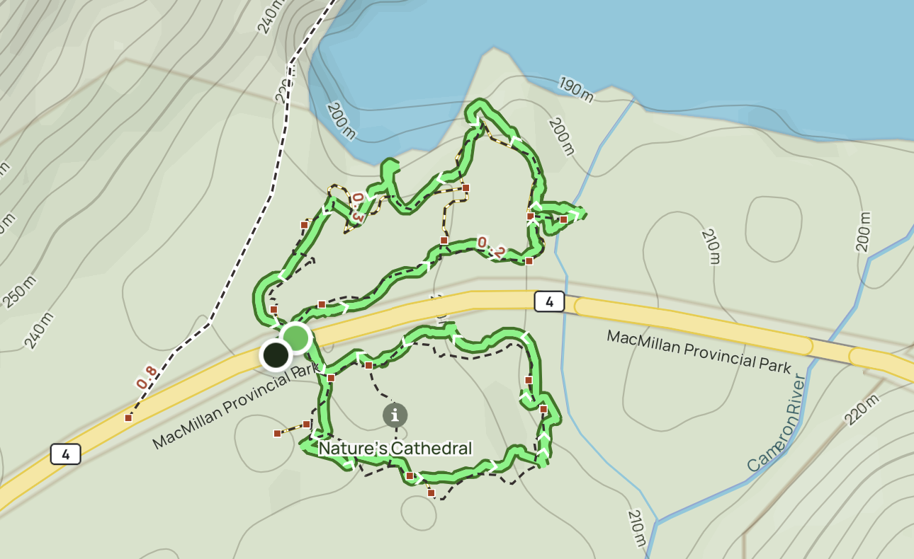
Cinque Terre, Italy – Porto Venere to Manarola

Trip report by BestHike editor Rick McCharles

In 2010, I hiked the famed Sentiero Azzurro aka Verde Azzurro path, or “Blue trail”.

It connected the 5 main villages of the the Cinque Terre National Park, a UNESCO World Heritage Site. Riomaggiore to Monterosso al Mare.

Sadly, since 2011 sections of the classic have been closed.


Returning in 2023, I decided to do part of the most popular alternative, the Sentiero Rosso aka Cinque Terre High Path.

Click PLAY or get a glimpse on YouTube.

A LOT of ascent and descent. But gorgeous vistas from high up.

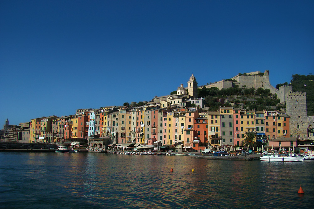
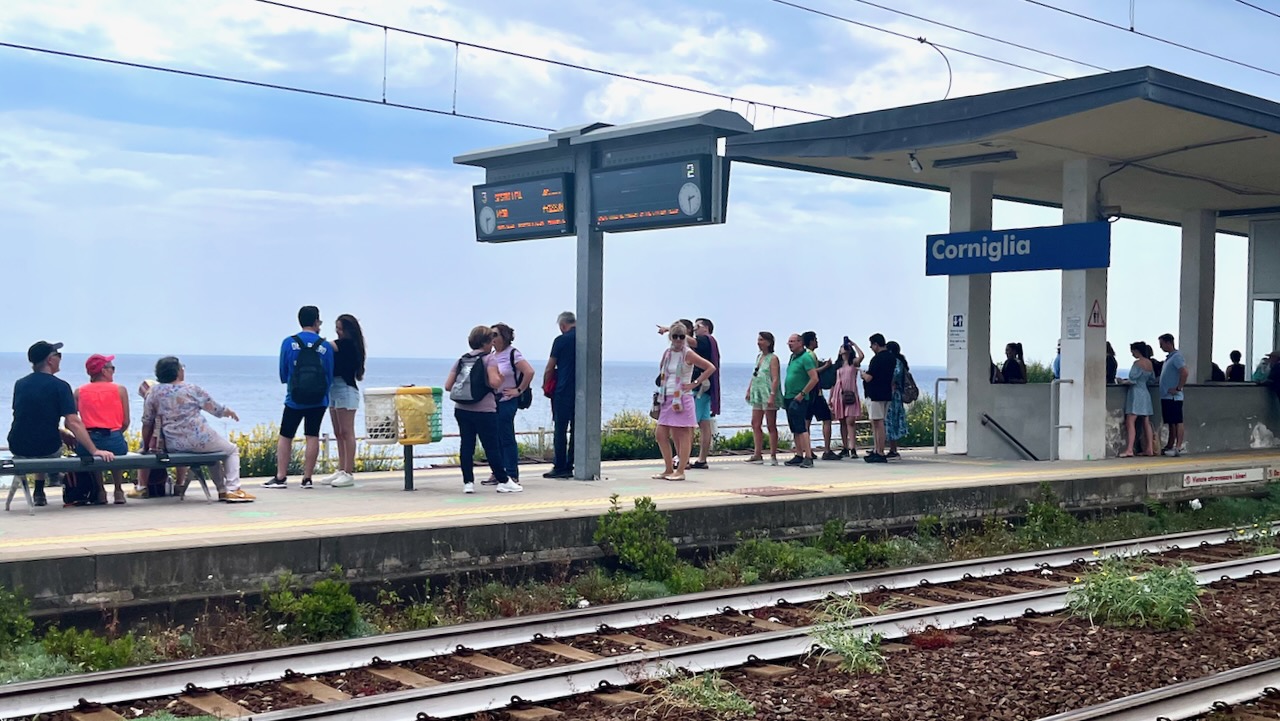
Took the train to La Spezia. Then the local bus to Porto Venere.

A pretty town.

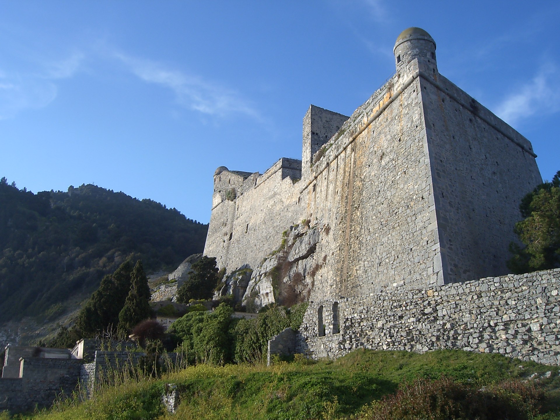
Starting the hike north, immediately you find the impressive Doria Castle.

EPSON DSC picture

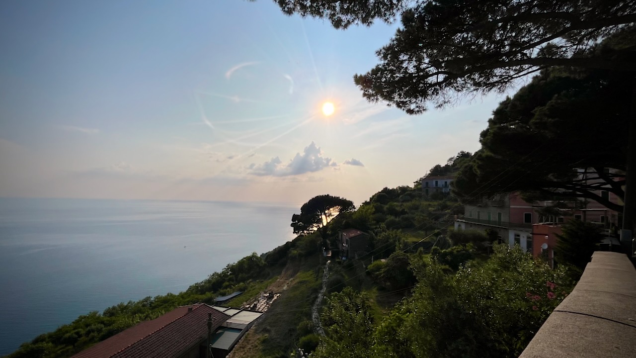
The trail takes you high above the ocean with terrific views in each direction. There are some very narrow pathways, but no real exposure.

I found a quiet spot, just before dark, to put up my tent.

Early next morning I arrived at the impressive Santuario di Montenero. The priest came out, interested in my drone. I showed him how it worked and later sent him this video.

Click PLAY or watch it on YouTube.

Flowers bloom in profusion in June. You can see why everyone loves these trails.

I climbed WAY DOWN to Riomaggiore. A charming seaside town.

At tourist information, I confirmed that the original Blue trail was still closed. Got a map and directions for the best high route.

The tunnel by the railway station was a highlight for me.

Up, up, up.

More amazing vistas from up high.

Finally, I caught the train in Corniglia, a little further on from Manarola. It was nice to have the freedom to finish the day whenever I wanted.

YES, the Cinque Terre is touristy. But taking the high trails mostly gets you away from the mobs.

I highly recommend this hiking destination.

Border Route Trail, Minnesota

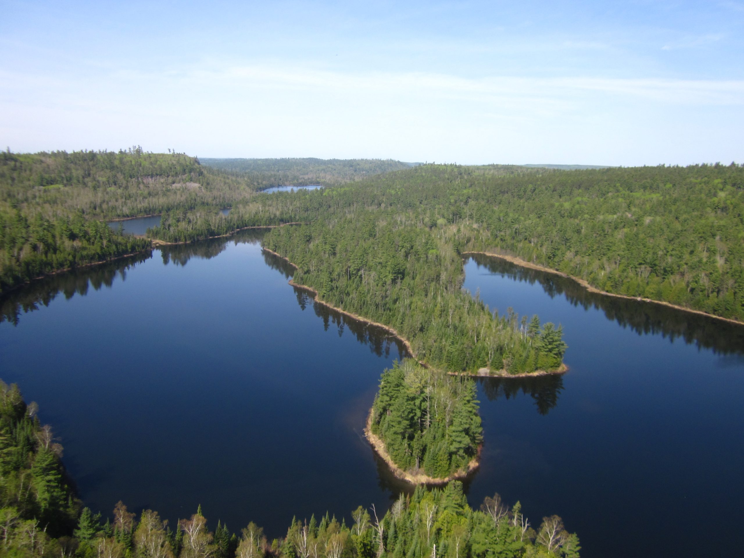
The Border Route Trail (BRT) is a 65-mile trail spanning the Boundary Waters Canoe Area Wilderness, an expanse of rolling hills, lakes, and forests that is a paradise for canoeists. 

The BRT is isolated, challenging, logistically difficult to get to, and itโ€™s worth every step. …

The Trek

Warning. Parts are overgrown. Click PLAY or watch it on YouTube.

American Prairie nature reserve

American Prairie is a massive prairie-based nature reserve in northeastern Montana being developed as a private project of the American Prairie Foundation (APF).

This independent non-profit organization is creating a wildlife conservation area …

… opportunities such as hiking, mountain biking, hunting and fishing …

Within large but securely fenced areas, APF is developing a bison herd free from cattle genes. …

americanprairie.org

Click PLAY or watch it on YouTube.

Hiking the Drakensberg, South Africa

The Drakensberg escarpment stretches for more than 1,000 kilometres (600 miles). Some of the best hiking in Africa.

Click PLAY or watch it on YouTube. One of the best hiking videos I can recall. Ever.

Harmen Hoek:

In March 2022 I solo hiked for 8-days in the Drakensberg mountains on the border of South Africa and Lesotho.

My route started in Cathedral Peak in uKhahlamba-Drakensberg Park in the KwaZulu-Natal province of South Africa.

I hiked up to the escarpment via Organ Pipes Pass where I headed north towards the Mnweni area. I got down the escarpment via Rockeries Pass for resupplies and back up (bushwacking) via Fangs Pass.

North at the top of Tugela Falls in the Amphitheater of Royal Natal National Park I met up with my dad to spend one last night up the escarpment.

We got down via the infamous Sentinel Ladder.

Favorite hike in the world. The weather, terrain, views, people and remoteness make this hike really unique. Also the most challenging hike to date.

#10 – Overland Track, Australia

Tasmania’s Overland Track is one of our top 10 hikes in the world.

Why?

Our favourite multi-day tramp in Australia. ๐Ÿ˜Ž

  • surreal, unique Tasmanian vistas
  • pretty lakes, tarns and waterfalls
  • exiting by ferry, it’s minimum 62km (38.5mi) carrying a pack plus many possible sidetrips without a pack. Elevation Gain: +4,793 ft / 1,461 m
  • Elevation Loss: -5,160 ft / 1,573 m
  • 8000-9000 walkers / year
  • 60 walkers start / day in high season
  • Oct 1 – May 31 Overland Track Pass reservations online
  • access by public transportation
  • easy-moderate hiking IF the weather cooperates
  • add challenging sidetrip peak scrambles if the weather is good
  • Nov – early May best months
  • possible to hike year round (snow travel during the winter)

World โ†’ Austalasia โ†’ Australia โ†’ Overland

Overland_Tassie_location_map
Gorgeous graphic via Warwick Sprawson

Click PLAY or watch a 1 minute preview on YouTube.ย 

For details click over to our Overland Track information page.

#7 – ย Otter Trail, South Africa

The Otter Trail is one of our top 10 hikes in the world.

Why?

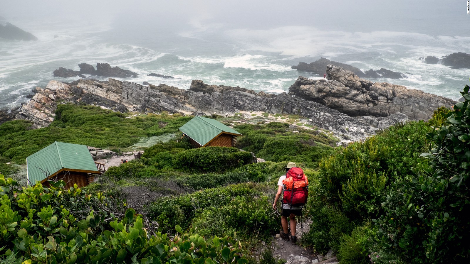
Lush forests, rugged shorelines, river crossings, waterfalls and fragrantย fynbosย make this adventure at the southern tip of Africa unique. Itโ€™s strenuous, with lots of ups and downs โ€ฆ

  • non-stop superb hiking
  • one of our top 10 coastal hikes in the world
  • Storms River Mouth to Nature’s Valley
  • 42km
  • 5 days, 4 nights
  • huts or tenting
  • permits are difficult to get as only 12 hikers start each day. December and Easter holidays are highest demand.
  • Recommended to book 12 months in advance. (Because folks book so early, it’s often possible to get a last minute cancellation spot.)

World โ†’ Australasia โ†’ New Zealand โ†’ Tongariro Circuit

CNN
... one way to cross the Bloekrantz
River crossings are a challenge.

Click PLAY or watch a 1 minute preview on YouTube.

For details click over to our Otter Trail Information page.

Surviving Vancouver Island Wilderness – ALONE TV

Alone (TV series) … follows the self-documented daily struggles of 10 individuals (seven paired teams in season 4) as they survive alone in the wilderness for as long as possible using a limited amount of survival equipment. …

They may “tap out” at any time, or be removed due to failing a medical check-in. The contestant who remains the longest wins a grand prize of $500,000. …

Seasons 1, 2 and 4 were shot on Vancouver Island.

The first season premiered 2015.

They were dropped on Quatsino Sound in Northern Vancouver Island, Canada, only accessible by boat or float plane.

As I hike and cycle a lot on the Island, I was keen to see how mere mortals could live off the land in a remote rain forest.

Starting a fire was the first big challenge. EVERYTHING is wet all the time.

Food was the long term challenge.

Lucas was by far the most skilled in season 1. He built a boat, yurt and even a musical instrument.

But Lucas didn’t take home the $500K first prize. That went to the contestant that was psychologically strongest. I do believe he could have lasted weeks longer โ€” though he lost over 60 pounds.


The 10 people selected for season 2 were better prepared. The challenge was the same โ€” remote, wet Vancouver Island. Though the weather was better.

The final four all found ways to last a long time. But as winter approached, the food supply dwindled.

Nicole was one of my favourites. Marine biologist. Expert in intertidal zone ecosystem. Knows what plants to eat. What plants not to eat.

She had the luxury of letting a big salmon go free one day. Wow.

I was cheering Jose, as well, a Spaniard who had adopted the ways of the North American indigenous peoples. His kayak is amazing.

In the end, missing loved ones at home was the final reason to tap out.

Click PLAY or watch it on YouTube.


Season 4 had seven teams of family members competing against one another.

Same geographical location.

Personally, I found the pairs stories less interesting. Did not finish the season.

Vermont’s Long Trail

I met Alan Wechsler on the John Muir Trail this past summer. I hiked in parallel with his group, finishing the same day at Whitney Portal.

Alan convinced me to put Vermont’s Long Trail in autumn on my personal life list. He suggested I follow the changing of the leaves starting late September and hiking south.

272 miles (437ย km). 70 backcountry campsites.

Details.

Alan is a writer and photographer based in the Northeast. He recently spent a year section-hiking the Long Trail in various seasons. His 73-page narrative describes the challenge and history of the trail, along with the people he met along the way, and is generously illustrated with his photos. Download the e-book here:

ย