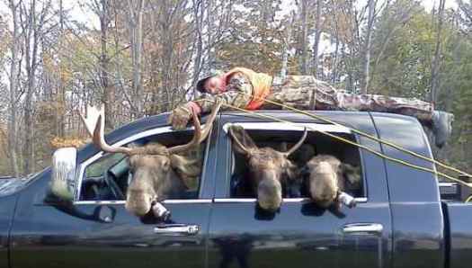
At a New Years Eve party I happened to meet the man first on scene at this tragedy.
It turns out that the hunter in Idaho who the authorities thought was killed by a wounded grizzly bear was actually shot by his young hunting companion, who was trying to kill the bear, an autopsy has revealed.
Steve Stevenson, 39, died on Sept. 16 when he was shot in the chest once by his 20-year-old hunting companion, Ty Bell, officials said. The two men, both from Winnemucca, Nev., were tracking a grizzly bear they had wounded in rugged country on the Idaho-Montana border, thinking it was a black bear, the surviving hunter said. …
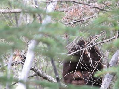
But a film crew from Discovery’s Animal Planet show, Finding Bigfoot, is in my back yard:
… Reports of hairy encounters with Bigfoot-like creatures in the Banff area are on the rise.
Earlier this month, crews from Discovery’s Animal Planet show, Finding Bigfoot, visited the mountainous region after seeing photos and video from the Sylvanic group claiming a colony of unidentified primates lives near the border between Banff and Kootenay National Park. …
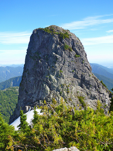
The Lions are a pair of pointed peaks (West Lion – 1,646 m (5,400 ft); East Lion – 1,606 m (5,269 ft)) along the North Shore Mountains in Metro Vancouver, British Columbia, Canada. They can be seen from much of the Greater Vancouver area …
The city’s BC Lions CFL football team is also named in their honour. …
On the September long weekend, a friend dropped me off at Cypress Bowl Ski Resort, only 20min from North Vancouver.
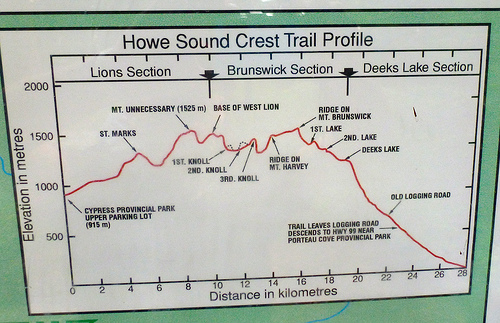
Of several trailhead options to visit the Lions, I recommend this one. Check the elevation profile:
(Most hikers, instead, start closer to sea level on the Binkert Trail, a long slog uphill.)
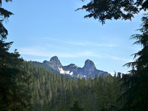
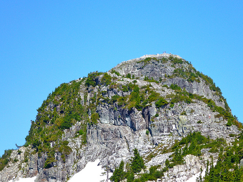
Here’s my first view of the Lions:
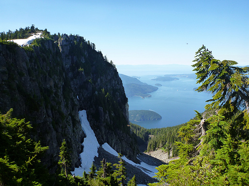
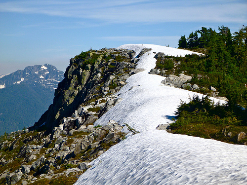
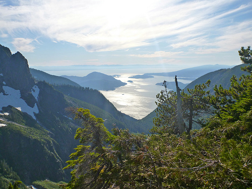
The first hour or so climbing up out of Cypress is tree locked. But you soon find yourself on a wonderful ridge walk with vistas like this:
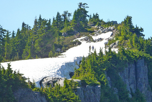
In early September the #1 question was still: “How’s the snow?”
No problem when I was there. In fact, where the trail crossed snow the footing was good, progress just as fast as on ground.
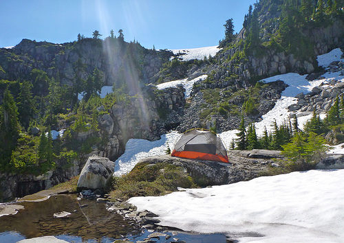
For lunch I decided to set up the tent on a warm rock.
I read my book. Listened to audiocasts on my iPod. And had a nap. The tent was essential to escape the voracious mosquitoes and bothersome noseeems, unusual on the west coast, especially in September. There were none at lower elevations.
Look closely and you’ll see people atop the west Lion:
There are helicopter rescues nearly every summer weekend. And hikers do fall.
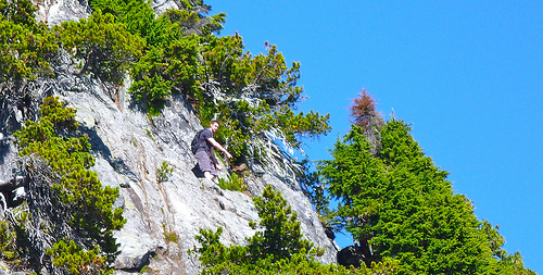
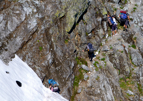
On arriving at the base of the west Lion I instantly decided not to scramble up. It looks sketchy. And there were all kinds of inexperienced, unprepared idiots crowding the route.
Instead I continued on the Howe Sound Crest Trail between the Lions. This traverse section was the trickiest of all. Considerable exposure.
The views of the Lions are stunning from every angle.
east Lion
Past the Lions there are very few hikers. The trail is indistinct, to say the least.
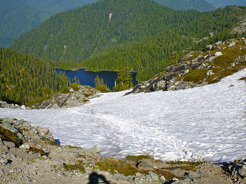
Here I glissaded down towards the lake.
… Unfortunately, the actual trail stays high on the ridge. I need to bushwhack back up to find it.
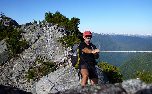
At this point someone had installed a chain and comfort rope, not needed in this ideal weather.
Soon after that chain, the trail gets very rough. One hiker with a dog decided to turn around. It was canine impassible.
I got fed up myself after one particularly steep, ugly down scramble. And decided to finally set up my tent for the night.
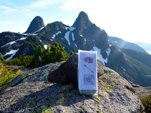
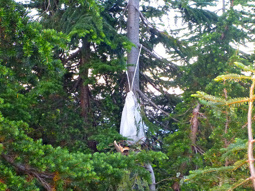
There was no suitable cliff nor tree limb for hanging my food, so I used the Ursack system for the first time.
… 45min later I could hear some animal clawing a tree. I assumed a bear had taken my food.
I stayed the night as it was impossible to find the faint trail in the dark. When morning dawned I went to photograph the damage, and found the food untouched. One small tree nearby had been broken though. (… I’m still not sure what animal had caused the ruckus I heard the night before.)
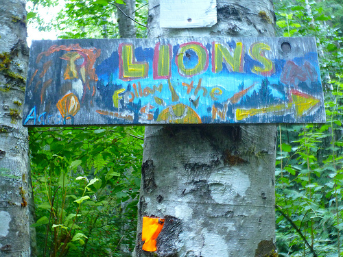
Due to too rough trail, I decided to escape the Howe Sound Crest Trail early. The nearest exit was via some new (wet) trail recently hacked out of the woods. It was flagged but poorly signed. People had created home made signage to compensate. This was the most artistic:
I ended up in Lions Bay after connecting to the Binkert. From there you can find a bus back to Vancouver.
_____
Leave a comment if you have a recommendation on the best trail back down to Highway 99. Is it worth continuing to the end of the HSC trail?
In the end, I’d still rank this as one of the best hikes in B.C.
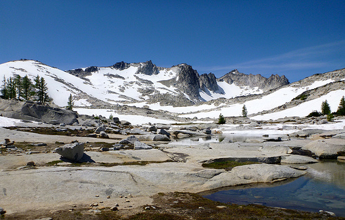
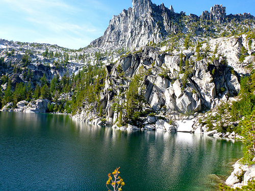
… (are) located entirely within the Alpine Lakes Wilderness about 15 miles (24 km) southwest of Leavenworth, Washington in the United States. The Enchantments is regarded as one of the most spectacular locations in the Cascade Range. …
Dawn broke clear and calm. But I did not get out of the tent early, fearing mosquitoes. It’s buggy close to these lakes, even in August. Climbers told me that mosquitoes chase them all the way to the windy summits.
Once on foot, I needed to keep moving briskly to stay ahead of the bloodsuckers. The scenery was gorgeous, though.
This was the only time I got my feet wet all day. (Lucky, I thought, considering I was trekking ‘alpine lakes’.)
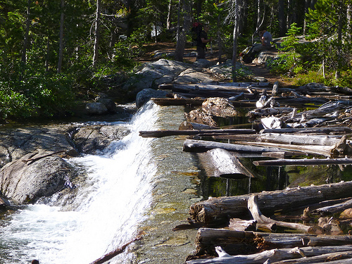
The many waterfalls are impressive.
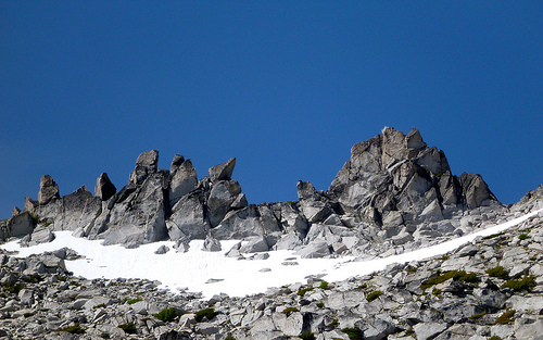
But for me and most, the highlight are the high, stark lakes. And craggy ridges.
I hiked directly to Aasgard Pass. Then — for FUN — returned by scrambling off-trail high above the regular route.
Surprisingly, I made even better time on the return trip … and suffered no roadblocks … until this point …
I tried descending to the far side of the lake and walking the shoreline. It would not go.
Rather than backtrack I scrambled up the cliff. Not too smart. I was lucky I didn’t splash down in the cold lake.
From there it was an easy out back down to my tent. The double traverse took me about 10hrs walking.
Hiking the Enchantments in Autumn (PHOTOS) is highly recommended. The Larch are golden. And there are NO BUGS.
_____
The most unusual thing about the Enchantments are the tame mountain goats.
In recent years, they have become a little too friendly with people, in some cases acting aggressively. These are large, powerful animals, and need to be treated with caution. Enjoy them from a distance and don’t encourage them. They are also very attracted to human urine; please use the toilets where provided, or urinate into gaps between boulders or other places that will prevent them from pawing up plants and soils …
A few clips from my 3 day double traverse. (Trip report to come.)
Fish wanting to jump into your fry pan, the weirdest waterfall you’ll ever encounter and FRIENDLY MOUNTAIN GOATS. … They’ve habituated to humans, craving the salt in our urine. One followed me for an hour.
The major bird cliffs of Iceland ranked #1 on a Lonely Planet list of the greatest wildlife spectacles worldwide.
1. Látrabjarg bird cliffs, Iceland
The famed white cliff s of Dover get their hue from the chalk stratum. At Látrabjarg, the very far western extremity of Iceland (and Europe), the rock faces – some over 400m high, and about 12km along – aren’t naturally white. When you hear that these cliff s host the summer roosts of millions of seabirds, you’ll guess what those stains are: an unbelievable quantity of guano. The swirling, squawking cacophony of puffins, razorbills, guillemots, fulmars, cormorants and kittiwakes is extraordinary; even if you’re not into birdwatching, the comic antics of the puffins and the sheer scale of the mob are mesmerizing.
Access is easiest with a car, though a bus runs three times weekly from June to August from Isafjordur, the Westfjords region’s main town. …
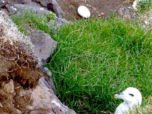
On the Hellnar to Arnarstapi coastal walk in Iceland I nearly tripped over a fox. We were both trying to get close to nesting sea birds on coastal cliffs.
The Snaefellsnes Peninsula, close to Reykjavik, is a popular hiking destination.
Of many possible coastal walks, I chose the most popular, Hellnar to Arnarstapi.
It’s busy, but I still loved it. You can drop non-hikers in your group at the trailhead Coffee shop.
There are restaurants at either end of the trail, as well. Here’s pretty Arnarstapi.
The Visitor Centre is in Hellnar. I got good advice there.
This section of the coast is famed for “weather worn caves and sea arches“.
The vistas are gorgeous, for sure.
I nearly tripped over one of the supposedly rare Arctic Foxes. (That’s my 3rd in 4 days. How rare could they be?)
The fox was picking up an easy lunch. Dumber birds hatch eggs too close to the cliff top. I could have collected enough for an omelet, myself, without scrambling.
I’m happy with the photos from this day hike. See the rest on flickr. They are geotagged automatically by my new camera.