Though decommissioned in 1999, you can still climb the wooden stairway with 4,444 steps. The longest wooden staircase in the world.
Some call this adventure Flørli 4444.
There are longer staircases in the world. Highest is the service stairway for the Niesenbahnfunicular railway near Spiez, Switzerland, with 11,674 steps. But that one is only open to the public one day a year.
As I post the current operation system of Mac computers is called Catalina.
… only 27 miles off the coast of southern California.
Though Catalina is a short 90 minute boat ride away, it feels like another world. There are two small, quaint towns on the island — Avalon and Two Harbors — and the remainder of the island is primarily wilderness managed by the Catalina Island Conservancy.
The 37.2 mile Trans-Catalina Trail traverses the entire island, from Avalon on the eastern tip to Starlight beach at the western end.
Of course, once you get to the end, you’ve still got to hike back to Two Harbors to catch a boat back to the mainland. This adds another nine miles, making the total mileage a bit over 46 miles — perfect for a long weekend backpack getaway. …
UPDATE – About 7500 hikers have permits for the West Coast Trail starting May 1st. But the hike is not being prepped right now — my guess is that it will be closed for all of 2020.
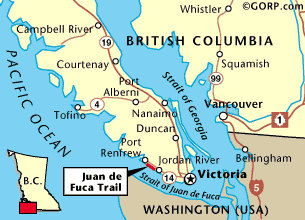
Since the start of this website we’ve ranked the West Coast Trail on Vancouver Island our favourite multi-day hike anywhere.
Michael Atkinson places himself in the historic predicament of two stranded German aviators in 1932 to see if the his skills as a survival instructor, pilot and adventurer will allow him to escape to the nearest civilization.
It is a gripping film.
I learned a lot about surviving in the harsh Australian coastal wilderness.
The most remarkable feature of this documentary is its mode of filming. It is not performed by any film crew that follows his journey. It is single-handedly managed by Mike through drones and cameras so it preserves the natural element. The breathtaking pictures of the ocean, varied shades of the waters, flora and fauna of marine sea and the natural cliffs along the coast paint an excellent landscape for the viewers. It manages to take one to an unexplored world …
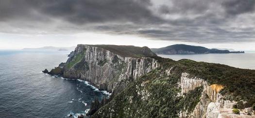
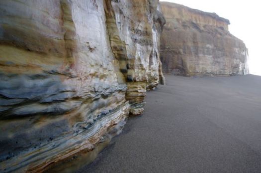
Has the Overland Track, Australia’s most famous long-distance walk, just been usurped? Edging along the tops of cliffs that soar more than 300m above the unruly Southern Ocean, the Three Capes Track (threecapestrack.com.au) has quickly assumed the mantle of Australia’s most intriguing bushwalk.
The four-day, 46km track opened to huge expectations at the end of 2015 …
… criticisms that have hounded the track are the cost (at AU$495 per person, it’s more than double the price of the Overland Track) and initially there were no camping facilities for traditional bushwalkers. …
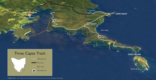
To regulate walker numbers, which have been capped at 48 setting out each day, Tasmania’s Parks and Wildlife Service has established a permit system. Bookings should be made at threecapestrack.com.au/booking.
The walk officially begins at the Port Arthur Historic Site, about a 90-minute drive from the Tasmanian capital of Hobart.
The Dragon’s Back is more than a hike, it’s a “tourist attraction”.
The Dragon’s Back (Traditional Chinese: 龍脊) is a ridge in southeastern Hong Kong Island, Hong Kong, between Wan Cham Shan and Shek O Peak. It lies within the Shek O Country Park. In 2004 the Dragon’s Back Trail was selected by TIMEasia as the best urban hiking trail.
Who wouldn’t love a ridge walk on a tropical island?
Many start up the Hong Kong tram and hike down to Big Wave Bay, but I followed the longer and more difficult 8.5km route recommended in The Inside Guide to Hikes and Walks in Hong Kong, a free publication from Hong Kong Tourism.
If you get to Hong Kong, the Dragon’s Back is a must hike.
Friends, loved ones and unloved who don’t want to go can wait at the finish, Big Wave Bay Beach.
From towering Neahkahnie Mountain to the chasms of Cape Perpetua, there are hiking trails that run up and down our gorgeous coastline, exploring the forests, dunes, tide pools and beaches that make it up.
… One of the best things about hiking the Oregon coast is how easily you can access such incredible views …
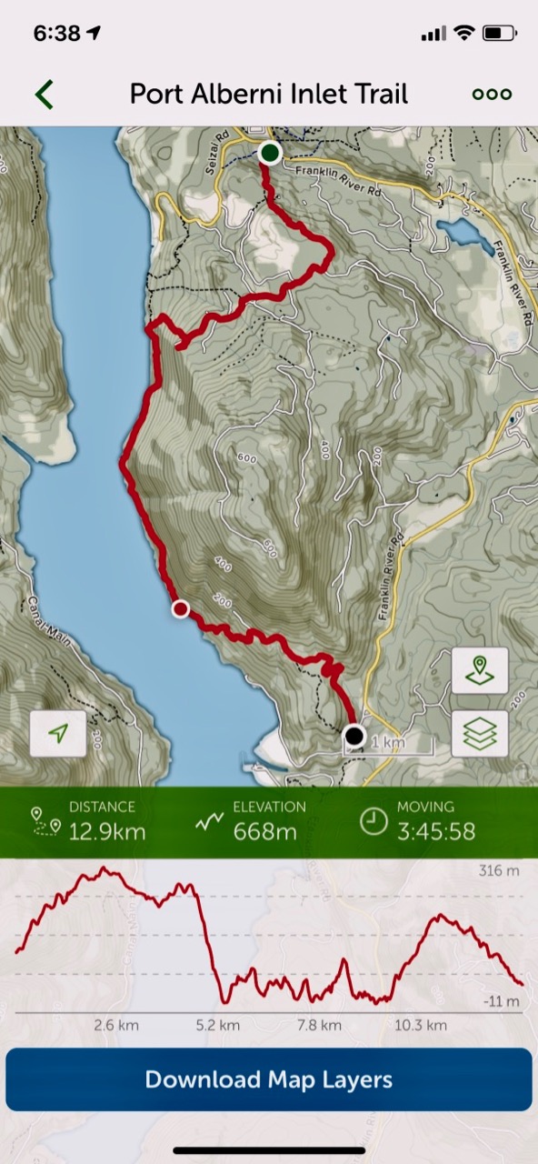
For my first hike, I used the paid version of the AllTrails app. And I needed AllTrails as parts of the trail close to China Creek are overgrown and difficult to find.
Even better is the Relive app. Click PLAY or relive my hike on YouTube.
It was tougher than I expected with non-stop up and downs.
There are many bears in the area. This was the only sign I saw.
In fact, the only animal life of interest was the first Garter Snake I’ve seen this season.
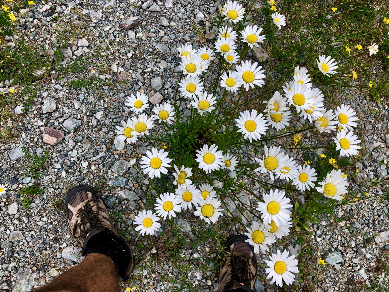
Wild flowers lovely.
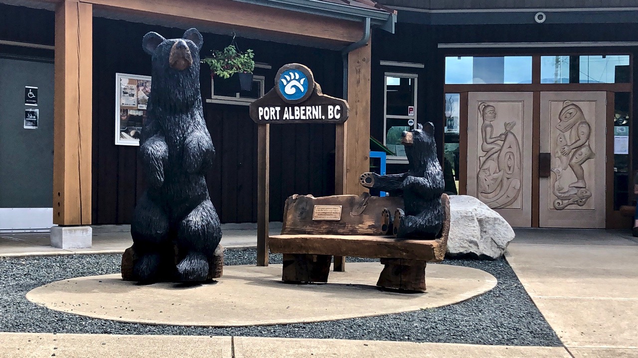
This trail is maintained. But the section closer to Port Alberni is in far better shape.
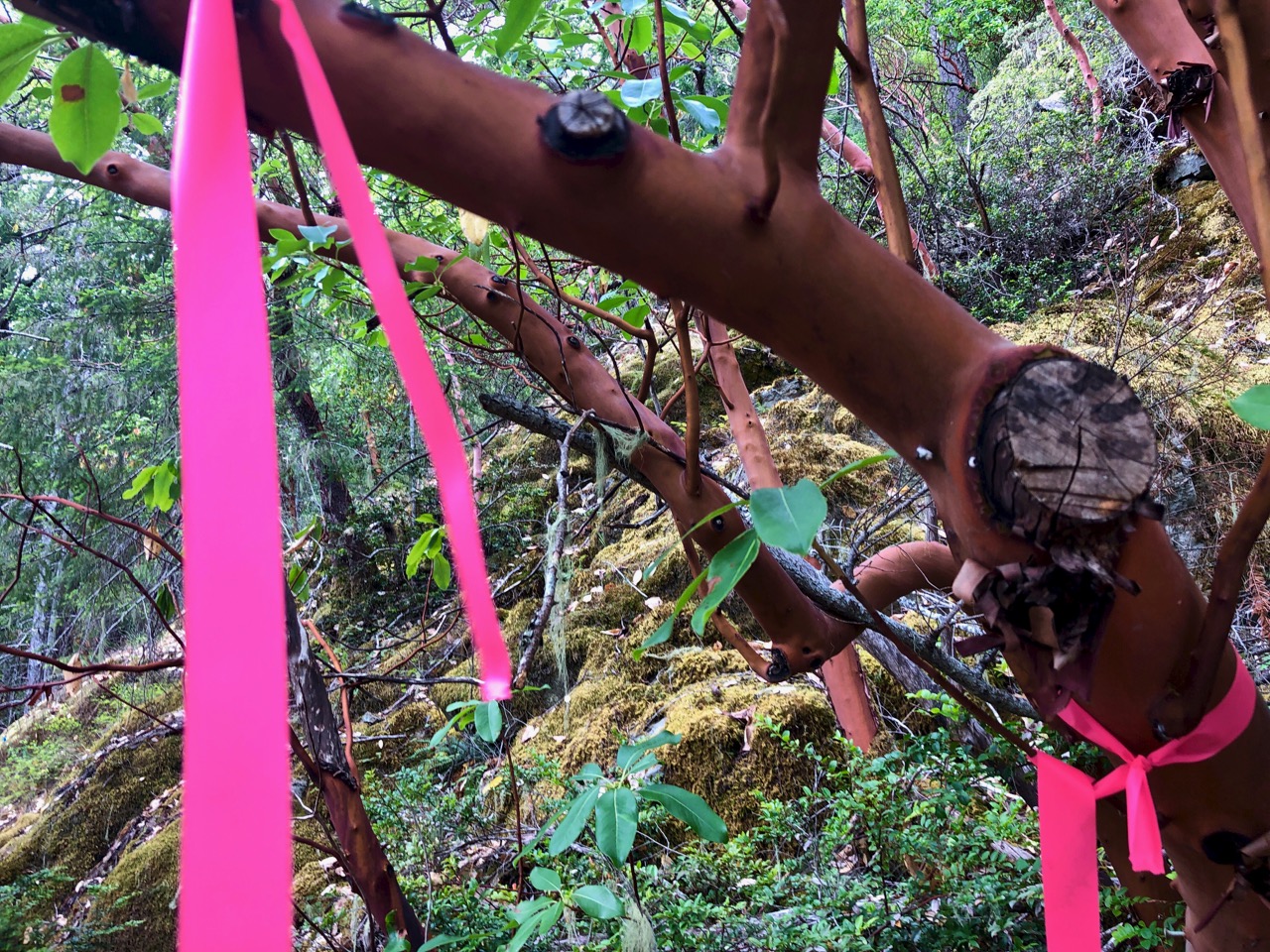
At times you have to rely on flagging tape to find the trail.
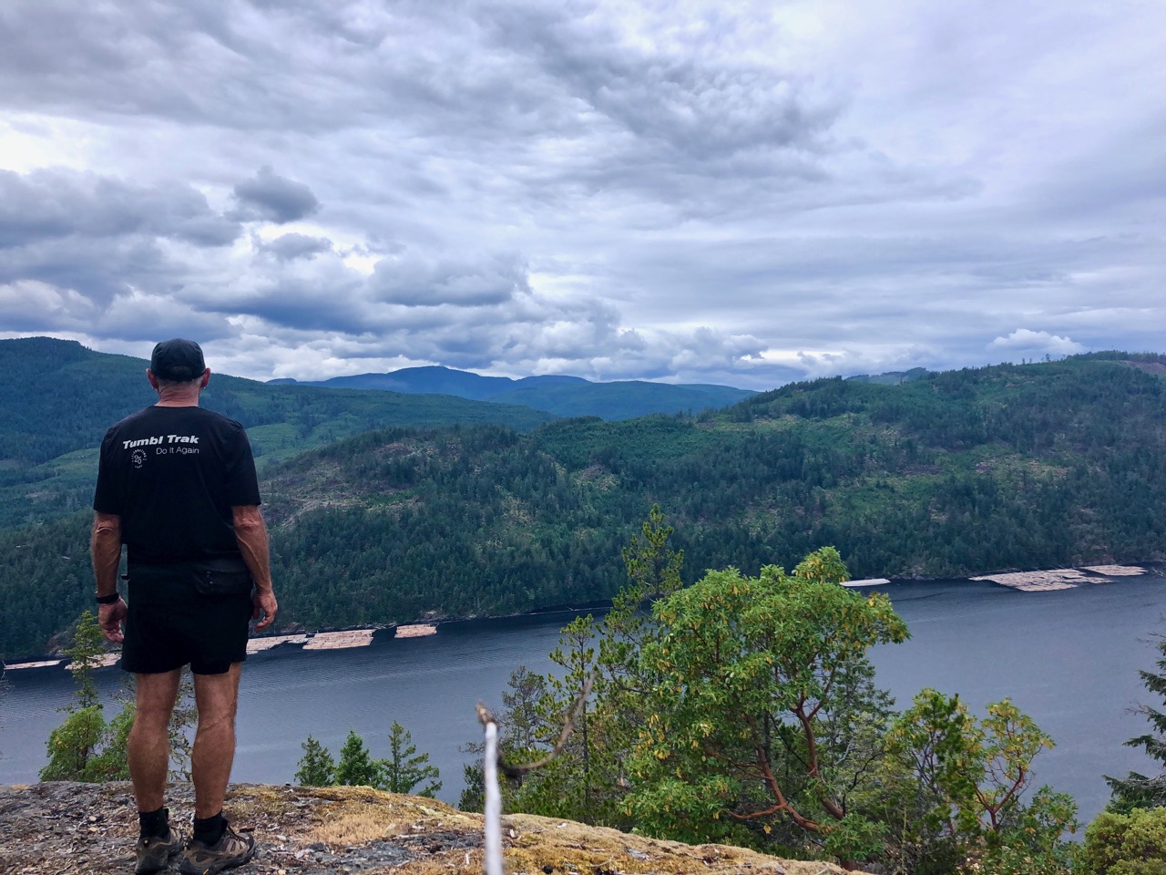
One highlight is a vista of Port Alberni from on high.
The coastal section is cool. Boom.
All in all, I’d recommend the Alberni Inlet trail.
There are three main multi-day hiking trails on Stewart Island:
Rakiura Track (3 days) North West Circuit (9-11 days) Southern Circuit (6 days)
Stewart Island can be visited all year round, and it possible to do the aforementioned hikes at any time of the year. But, our recommendation is to visit sometime during the peak summer months, when the weather is warmer, sunny days are (slightly) more likely, and the daylight hours are longer.

 AT A GLANCE