Born and raised in nearby Calgary, Alberta — Waterton is my favourite Canadian National Park. I’ve been there dozens of times over the decades.
Many tourists rush to Banff National Park, missing Waterton. And that’s a shame.
Campsites book quickly, so reserve early. Several months ahead.
Gemma and JR posted their advice:
… a three day Waterton Lakes National Park itinerary, based on our favourite experiences and the activities that I think showcase the best of the park. We’ve explored Waterton multiple times, across different seasons. …
For a quieter (and cheaper) trip, visit in mid/late May, June or September. …
- A national park pass is required to enter and explore Waterton Lakes National Park
- From 19th June to 7th September 2026, there are no admission fees for national parks and national historic sites operated by Parks Canada (Canada Strong program)
- Mid/late May to late September is the best time to visit
- Facilities, trails and services are more limited outside of this time period, especially during the winter months
- Reservations for the Townsite campground open in January each year. The date is usually revealed on this Parks Canada page in late November, early December
- In 2017, a major wildfire swept through the western side of Waterton (39% of the park). Burned trees are still visible in many areas. Learn more about the fire at the Visitor Centre
Waterton Lakes National Park 3 Day Itinerary: Hiking, Wildlife and Waterfalls
Click PLAY or watch highlights on YouTube.
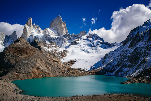
Across the border is Glacier National Park, Montana.
One of our top 10 hikes in the world is Glacier North Circle which can include both parks. You will see a lot of wildlife in both.
Click PLAY or watch it on YouTube.