The RAB film In the Footsteps of Banryu follows athletes Jake Baggaley, Aoi Chan, Yusuke Tannaka, and Sam Hill as they attempt to fast pack a route known as the Kamikochi, Yarigatake, and Hotaka Circuit. This path, following knife-edge ridges and climbing jagged peaks …
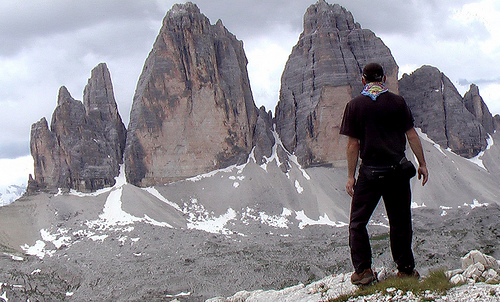
You can see weird and wild limestone spires right from town. Convenient, efficient public transport makes for easy access to trails for hikers of all levels of ability.
BAD NEWS. As of April 1, 2023 the Nepal government required that major treks can no longer be done independently. Hiring a guide is mandatory. The obvious alternative for independent hikers is the Indian Himalaya.
UPDATE April 2024. The Everest region refused to enforce mandatory guides. Hikers are doing Base Camp independently.
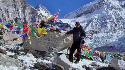
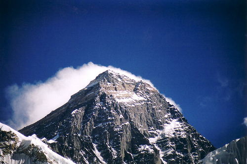
Every hiker dreams of trekking in the footsteps of Hillary and Norgay. Climbing to Mt. Everest Base Camp Qomolangma (Tibetan), Sagarmāthā (Nepali) should be on your bucket list.
Here is the finest alpine scenery in the world, we reckon.
Namche Bazaar … at 3,440 metres (11,286 ft) … is the main trading center for the Khumbu region with many Nepalese officials, a police check post and a bank. …
Namche has a permanent population of around 800.
Almost everyone trekking in the Khumbu region will visit Namche Bazaar, as it is the gateway to the high Himalaya.
This is the cool Canadian Rockies hike these days. BUT it’s more of a route than a trail.
As evidence, I bumped into two of the top hiking YouTubers below the ridge — Eric Hanson and Justin Outdoors. We were heading opposite directions. Surprised and excited, I got a bit tongue twisted while chatting with them.
Slightly dangerous, Northover is not promoted by the Parks people.
I followed the route onAllTrails offline. No navigation problems.
My first tip is to WAIT for good weather. You don’t want to be on this narrow ridge in high wind and poor visibility.
On the drive up to the trailhead in Peter Lougheed Provincial Park, I had a good look at momma bear and 2 young ones. I saw another juvenile bear on the drive out. None on the trail.
I booked at Aster Lake Campground before driving up. By doing this I’d decided to hike it clockwise looking down at the map. But you can do the loop in either direction.
Peter Lougheed Provincial Park NOW requires a Conservation Pass if you have a vehicle. In 2025:
Daily Pass: $15 per vehicle
Yearly Pass: $90 per vehicle
My campsite pass was checked by Rangers. They do a great job here.
The hiking infrastructure for foreign tourists is not nearly so well developed. There are far fewer hiking guidebooks.
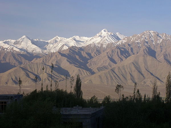
You need to do much more research when planning a hiking trip to India. The easiest jumping off point is Leh, Ladakh — a region administered by India as a union territory, and constituting a part of the larger region of Kashmir.
Stok Kangri seen from Leh
AT A GLANCE
Ladakh, Jammu & Kashmir, Himachal Pradesh, and Uttaranchal in the west
Darjeeling and Sikkim in the east
many peaks over 7000m (23000ft)
every serious hiker wants to travel to Nepal. The savvy trekkers to the Indian Himalaya, as well.
though challenging, India is a wonderful tourist destination
English is widely spoken
public transportation is slow at best, downright terrifying at worst
getting to the trailhead may be much more dangerous than anything you do on the trek. Take the train rather than a vehicle whenever you can.
best for experienced, confident, self-sufficient high altitude hikers
hiking season somewhere May-Nov (though micro-climates vary greatly). Many treks are not recommended Jul-Aug — though you can hike most places in Ladakh most of the year.
June 2025, Kraig Adams hiked 50 miles alone over 4 days on the Ak-Suu Traverse in Kyrgyzstan — a remote and challenging route through the stunning Tian Shan mountains.