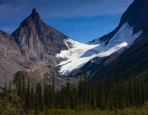
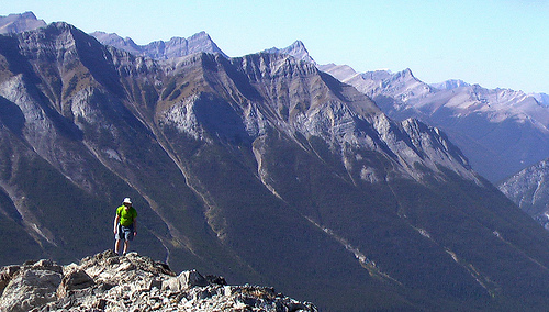
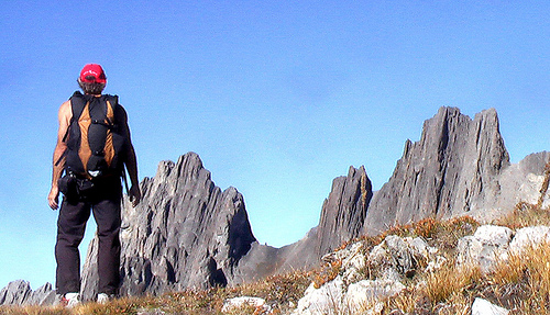
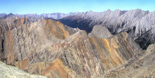
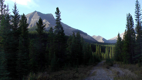
Rob and Jude this week did Burstall to see the larch changing on a classic Canadian Rockies day hike. They biked in and out 3km each direction, saving that time for a nap in the sunshine at the Pass.
Elevation Gain: 451 m (1,480 ft).
Great views once on top, with lots of opportunities for further hiking or scrambling.
I would grade this trail as difficult only if Burstall Creek is high (eg. late afternoon, early summer). Otherwise it is a good trail of average to moderate difficulty.
The general consensus of opinion usually names the GR20 high-level route across Corsica as the toughest of the Grande Randonees (SP), but with some justification the Pyranean Haute Route – which teeters across the frontiers of France and Spain – gathers a lot of votes.
GR20 Corsica - by Catching FliesPyrenees - click for more photos from the Wandering Ostrich
Both are long and demanding, have sections without proper paths, and journey through remote country, often far from habitation.
Yet there’s another long and challenging route that is also a contender for the title …
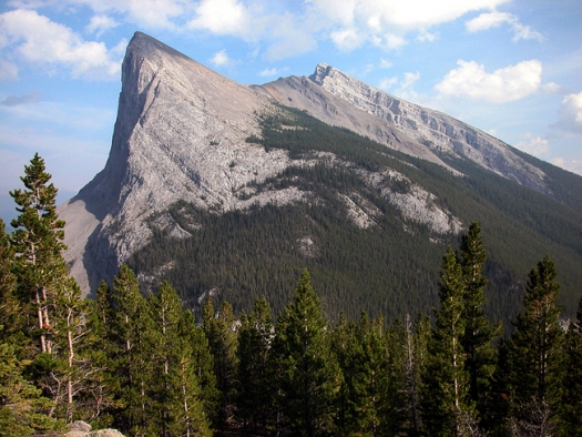
Anyone driving from Calgary towards Banff in the Canadian Rockies wonders what the view would be like from the top of this cliff.
Ha Ling Peak is a peak at the northwestern end of Mount Lawrence Grassi — a mountain located immediately south of the town of Canmore just east of the Spray Lakes road in Alberta’s Canadian Rockies. …
summitpost.org
Garth and I drove up to the mountains on a perfect Fall day. And enjoyed a leisurely half day hike to the top.
Garth
The backside is a relentless but fairly easy slog. This photo gives you a good idea of the angle of ascent.
This was the first time to climb Ha Ling for both Garth and myself.
The name of the mountain has been subject to much controversy. Originally, the mountain was referred to locally as The Beehive. In 1896 Ha Ling, a Chinese cook for the Canadian Pacific Railway (some say the Okaloosa Hotel in Canmore) was bet 50 dollars that he could not climb the peak and plant a flag on the summit in less than 10 hours.
According to the Medicine Hat News of October 24 1896, he started the ascent at 7:00 am the previous Saturday morning and was back in time for lunch. As nobody believed his story, he led a party of doubters to the summit where he planted a much larger flag beside the original, this one visible to the naked eye from Canmore. The townsfolk referred to the mountain as Chinaman’s Peak in his honour.
The name Chinaman’s Peak did not become official until 1980. Later, in 1997 it was renamed Ha Ling Peak as the term Chinaman was viewed as derogatory.
Get the guidebook. I did not have it with me, ending up taking the wrong ridge up. And the wrong ridge down. And missed a highlight, the “Hole in the Wall”.
Taking the wrong ridge is quite common:
… It is imperative that you are at the right spot, as I went up the wrong rib on this mountain years ago and was forced to redo this route in 2005 to complete it. There are several large ribs coming down from Mount Cory. You want the eastern most rib which is identified as light-colored shaley cliffs with a deep ravine to its right.
I was elated to get to the top after 4hrs. To celebrate, I rocked out to Coldplay for a half hour, enjoying the perfect weather close to 3000m. This is rare in the Canadian Rockies, any day of the year.
Chris Townsend in 1988 was the first to walk the continental divide of the Canadian Rockies, a 1600mi challenge. He declared the days from Assiniboine to Sunshine to Lake Ohara the finest section.
One of the best day hikes out of my home town, Calgary, is Banded Peak. But it’s a big day:
Something like 37 km return, a 1416m (4645ft) height gain.
Perhaps 27km on the bike and a 10km return hike/scree scramble to the 2,934m (9,626ft) summit.
Banded Peak from near the trailhead
Here’s the final deceptively easy looking approach.
summit
Banded Peak, together with Mount Glasgow, Mount Cornwall, and Outlaw Peak, forms a small range which lies between the Little Elbow River to the north and the Elbow River to the south. …
It’s become a tradition with the families of some of my hiking buddies to take their sons on this adventure as something of a rite of passage to manhood.
On Sept. 19th, 2009 we took three 13-yr-olds. They had to get to the top … or die trying.
Rob Glaser, our leader, was far from certain that a group this big could finish. And finish in time before night fall.
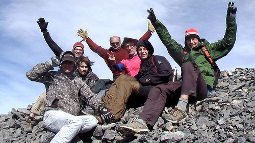
Here we are on the summit. Everyone made it. Somehow.
It was extremely windy on top. I’d estimate 80km/hr (50MPH).
Other than that, the weather was great for this time of the year. We were lucky.
Our best fun was some of the scree runs on descent.
Happily, we all made it back to the trailhead by 5:30PM.
As a career gymnastics coach, I can assure you that hiking is NOT the best way to get fit.
For each hour of exercise, gymnastics conditioning and Crossfit are the easiest ways to get strong and lose weight. Using your own body weight as resistance works best.
However, the LSD (Long Slow Distance) exercise methods do work. But they take many, many more hours.
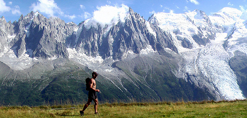
above Chamonix, France
I hiked most days this past summer, many with a full pack.
Within the first few weeks my fitness (for hiking) was perhaps best of my life.
Rarely could any walker pass me, with or without a pack.
Climbing Ben Nevis in Scotland I must have passed 700 people including trail runners who walked up, ran down. None passed me. The 1,344m (4,409 ft) seemed easy in the good weather.
You need weeks on the trail if you plan to get fit by hiking. But it will work.
Jeremy Twigg sends us the update on that inspiring fund-raiser:
I wanted to share some good news: Team IBDadventures safely reached the summit of Mount Kilimanjaro on September 13!
Says team member Clinton Shard from Squamish, BC:
“What an emotional roller coaster when we got to the summit. Incredible views, ice everywhere, and cold. Very cold. I hope when people hear about this trip they will recognize they can accomplish anything and they shouldn’t let Inflammatory Bowel Diseases stand in their way.”
In tribute to the greatest mountaineer of all time (Dick Bass, my ass), Reinhold Messner, I visited one of his Messner Mountain Museums. (He has 4 museums already and is working on a 5th.)
Reinhold Messner has dedicated to the mountains and the mountain culture a unique project, a network of museums located in five extraordinary places in the Alps. The Messner Mountain Museum is a place of encounter with the mountains, with humanity and ultimately with oneself.
The Messner Mountain Museum Firmian is located at Castle Sigmundskron near Bolzano, Reinhold’s home town.
It is very well done. I highly recommend it even to those not particularly interested in mountaineering.
In fact, the Himalayan section made me homesick for Nepal.
By the way, after 35yrs, in 2005, the remains of Günther Messner, Reinhold’s brother, were found on Nanga Parbat.
Reinhold had lived those decades with accusations that he abandoned his 23yr-old brother to die on that tragic expedition.
I always believed Reinhold’s version of the story. That his brother must have been caught in an avalanche.
It’s nice to see him vindicated in his own lifetime.