Fernie B.C. – GREAT Mountain Town

Though Iโ€™ve driven through Fernie, British Columbia, at least 100 times, Iโ€™d never before stopped as a tourist. ย 

It’s fantastic.

A.I.

A year round outdoor recreation mecca.

Hiking. Mountain biking. Rafting. River tubing.

Not to mention world-class fly fishing on the Elk River for cutthroat and bull trout.

Fernie is most famous for Alpine Skiing and Snowboarding.

There areย over 300 kilometersย of multi-use recreational trails accessible directly out of town.

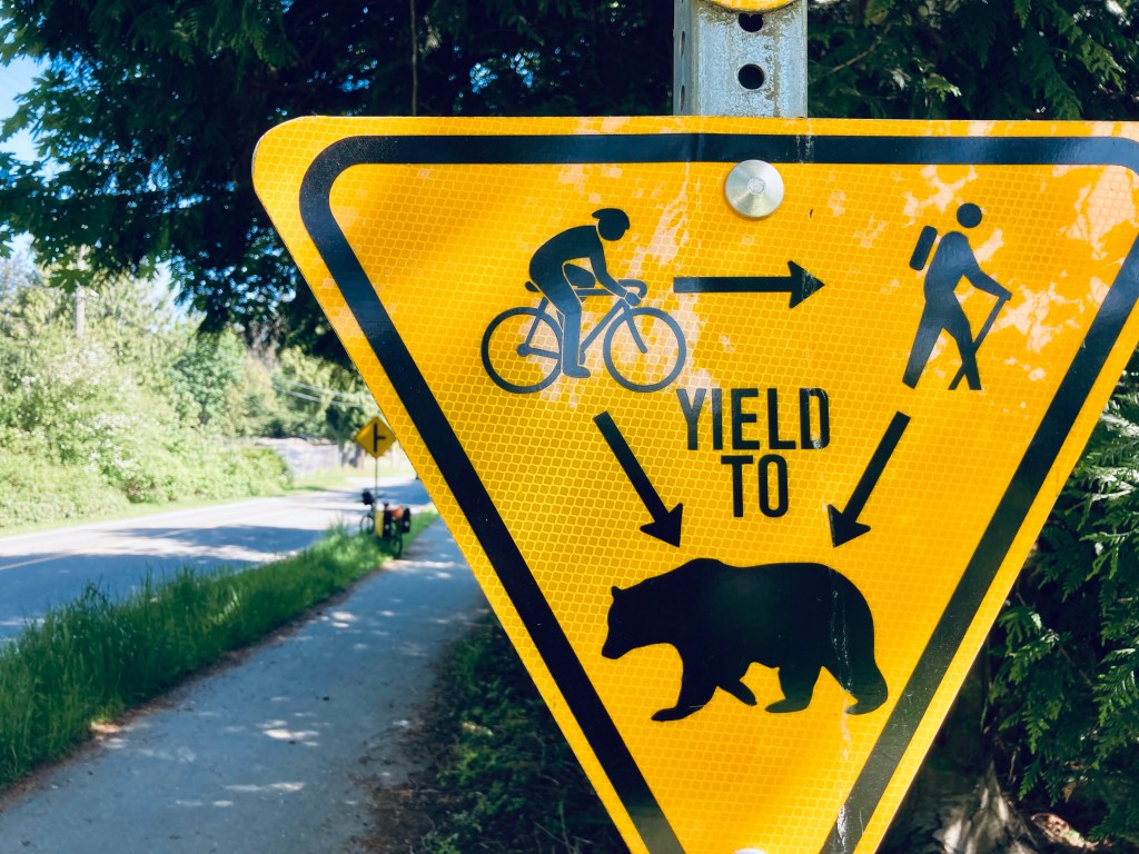
The owner of Edge of the World snowboard shop pointed out that he can hike or bike in any direction from town โ€” and be on a fantastic trail in minutes. (He also had to deploy bear spray to dissuade a Black Bear on the day of my arrival. There is plenty of wildlife around Fernie.)

There are 4 dedicated bike and outdoor shops in a town of less than 6500 locals!

tourismfernie.com

I only ended up exploring Fernie because I broke down my Bikepacking trip nearby.

I’ll be back for sure.

11 Days Cycling Vernon to Fernie, B.C.

Trip report by BestHike editor Rick McCharles

Out visiting friends in Kelowna and Vernon, my original plan was to cycle back to Calgary on the Trans Canada (Great) Trail.

I’d cycled Vancouver to Calgary on this route in 2020 โ€” so well knew the challenges. ๐Ÿ˜€

Vernon, Kelowna, Penticton

Here I am setting out from Vernon. Clean & keen.

I stopped by Sun Country Cycle in Vernon to have them top up air in the tires and look over the bike for any potential problems.

The Okanagan Rail Trail leaving Vernon is fantastic. This is not part of the Trans Canada Trail.

As you get closer to Kelowna, the route is not nearly so good. I was hurting, as well, and could barely walk after only about 60km. I checked into the hostel in Kelowna wondering if I’d be able to continue. My muscles were cramping badly.

BUT I did make it to Penticton. Still hurting, but less and less.

AND was able to cycle up to the Myra Canon trailhead โ€”ย though the 945-meter elevation gain at never more than 2% grade in the HEAT was tough!

I crashed that night.

Myra Canyon Trestles & Tunnels

The 18ย trestlesย and 2ย tunnelsย are one of the highlights of the entire Trans Canada Trail. This was my 3rd time here and I enjoyed them as much as ever.

Click PLAY or watch it on YouTube.

Kettle Valley Rail Trail

Myra Canyon is one small part of the 650 km Kettle Valley Rail Trail.

I continued on the KVR towards Calgary.

Fantastic views โ€” though the surface near Kelowna is very sandy & rocky. Those on eBikes were much happier than me. A good mountain bike would be better, as well, than my gravel bike.

On the other hand, I had the trail to myself most of every mile.

I stopped for coffee at Chute Lake, charging my electronics and filling up about 5 lites of water.

Up high on the trail, this was my brightest fire red sky at night. I was lucky to avoid any worse smokey air.

Columbia and Western Rail Trail

The KVR ends at Midway B.C.

I continued on towards the Columbia and Western Rail Trail. It’s about 162 km connecting Midway, Grand Forks, Christina Lake, and Castlegar.

Great sections, but not nearly as good as the KVR.

Highlights for me were sweeping views of the Granby Valley, Christina Lake, and Lower Arrow Lake.

And it offers ideal wild camping โ€” though there are not all that many water sources.

I enjoyed dinner every night, rehydrating meals frozen by my niece. Much tastier than any commercial camping dinners I’ve ever tried.

NEW for me is using a toy drone automatically following my bicycle.

Also new for me while bikepacking, is carrying a portable camping chair.

I love it!

Though rehydrating meals is ideal …

… I eventually had an urge for solid food.

Here I am saying goodbye to the Columbia and Western Rail Trail.

To Nelson & Crawford Bay

As we had a house in Crawford Bay B.C., I was keen to continue on to Nelson and the old homestead. But I was forced on to highways and rural roadways with … HILLS.

Why didn’t someone warn me there were HILLS in British Columbia? ๐Ÿ˜€

After flat rail trails, almost every ascent seems daunting. And HOT.

I love Nelson and checked into the hostel for a night. Happily, my friend Tam happened to be in Nelson at the same time and we were able to catch up for coffee.

Rather than cycle the dangerous tourist highway out of Nelson, I put my bike on the local bus to the Kootenay Lake ferry.

In 2020 the house my Dad built was in rough shape. Six years later it looks even worse.

I’m wondering when anyone actually last lived here.

Like 2020, I stopped for lunch at the fantastic Kokanee Springs Golf Course.

Busy, Dangerous 2-lane Highways

The highway from Crawford Bay to Creston is a favourite of mine. To drive.

On the bicycle it’s dangerous with very narrow shoulders in places.

I stopped at the Gray Creek General Store to inquire whether or not cyclists were taking the Trans Canada Trail up and over the Gray Creek Pass โ€” probably the most challenging section across the nation.

Not many, I was told.

  • Average of nearly 9% grade for 17 km from Kootenay Lake up to Gray Creek Pass
  • Average of nearly 6% grade for 12 km from Gray Creek Pass down to Parkerโ€™s Creek
  • No service
  • Rough surface
  • Not recommended

As I did in 2020, I chickened out and cycled the highway to Creston.

My first flat tire EVER on this bike. After trying to add air with my (crappy) hand pump, I saw there was a bike shop only 4km distant. Rolling my bike there, the street was shut down by police.

This was a crime scene. Stabbing, I was told. Possibly murder.

The bike shop owner happened to drive past, informing me it was still possible to enter the shop from the back. With no customers coming in the front door, they fixed the flat immediately and at low cost. Whew.

Creston to Cranbrook

Mostly highway. No photos.

Crawford Bay to Cranbook was the least interesting section.

Adventure Ends in Fernie

I got coffee in Cranbrook. And then tried to find the trail out of town.

It’s confusing. And I never found even one good navigation app for the Trans Canada Trail.

The end of my trip on day 11. ย  My rear rack broke off completely going over one of those bumpy cattle guards a few hours after leaving Cranbrook.

GMoney, a ski shop owner in Fernie โ€” whoโ€™s a punk musician in his spare time โ€”ย picked me up while I was hitchhiking.ย 

A big time hiker and cyclist, GMoney hosted me at his house and gave me advice on where I might get the bike fixed.ย 

Turns out none of the 4 bike shops in Fernie had the kind of tools to repair the rear rack.

I stayed at the excellent Angry Elk Hostel, as well, for a couple of nights โ€” enjoying Fernie for the 1st time โ€” until my brother & his wife came to my rescue.

(Same day GMoney collected me, he and a girlfriend were 2 yards away from an angry Black Bear with cubs.ย  Had to bear spray to stop her.ย  Thatโ€™s the closest bear encounter of anyone Iโ€™ve ever known.ย )

In the end, my cycling distance over the 11 days was around 750 km.

I Missed Fernie to Calgary

I broke down at the end of the worst highway sections, and the beginning of one of the best trail & gravel road parts of the entire Trans Canada Trail.

Here’s how Fernie to Calgary went for me in 2020.

I might have to go back to Fernie and finish the job.


Once finished, I experimented with different navigation apps. NONE are good.

Best of the worst …

African Elephants

A highlight of any safari in Africa is watching these gentle giants.

Theย African elephantย isย the world’s largest land mammal.ย 

Adult savanna bulls can stand up to 4 meters (13 feet) tall and weigh over 6,000 kg (13,000 lbs).

Their large, fan-like ears are famously shaped like the African continent. They use them to radiate excess body heat.

I studied them first in Addo Elephant National Park, South Africa in 2023.

They can live up to 70 years.

I saw even more elephants on my 5 Days, 4 Nights Camping safari inย Tanzania 2026.

They consume up to 150โ€“300 kg (330โ€“660 lbs) of vegetation daily, including grasses, bark, and fruit.

Most memorable was watching elephants give themselves aย mud bath.

Around 90% of African elephants have been wiped out in the past century – largely due to the ivory trade – leaving an estimated 415,000 wild elephants alive today.

One ranger I spoke with in Tanzania told me they no longer have any problem with poachers in his National Park.

Click PLAY or watch it on YouTube.

Nairobi Safari Walk and Animal Orphanage

Trip report by BestHike editor Rick McCharles

Adjacent to Nairobi National Park gates inside Nairobi city is the “animal orphanage“.

Click PLAY or see some of the protected animals on YouTube.

Nairobi National Park is exceptionally convenient, located just 7โ€“10 km (about a 30-minute drive) south of the city center. I stayed in an Eco Lodge, nearby.

David Sheldrick Trust runs the sanctuary where orphaned and sick animals from all over Kenya can recover. Many are released back into the wild. Some stay โ€” and people can visit. It’s something of a small zoo โ€” but where individual animals have interesting back stories.

For example, this statue commemorates Sebastian the chimpanzee who lived here 1956 – 1996.

Click PLAY or watch it on YouTube.

I bought a combined ticket to the orphanage and Safari Walk next door.

The Kenya Wildlife Service manages this small zoo displaying the variety of plants and animals that are in Kenya in a more natural setting than the orphanage.

White rhino, big cats, crocodiles, rhinoceros, antelopes, and primates.

People were hand feeding a small giraffe when I was there.

Like any animal prison, it’s not all good here. But thousands of Kenyan children on school field trips visit each week. Learning to value their indigenous wildlife.

Click PLAY or watch it on YouTube.

Combined tourist ticket price for both was about $42 in 2026.

5 Days, 4 Nights Camping Serengeti, Tanzania

Trip Report by BestHike editor Rick McCharles

Quick overview using just my own photos in this post. I’ll share more detailed information in the near future.

Click PLAY or watch it on YouTube.

There are over 500 companies offering Serengeti wildlife tours.

Least expensive โ€” about U.S. $200 / day in 2026 โ€” is sleeping in large canvas tents.

I signed up for one of the “Camping Safaris” that welcomed solo travellers.

DAY 1

Arusha to Tarangire National Park

A great start. Tarangire is known as the Elephant Paradise. We saw MANY elephants and giraffes close up.

Giraffes love munching on Acacia โ€” despite the very sharp spines.

Huge Baobab trees are a highlight, as well. I do love the African trees.

Home to more than 550 bird species, the park is a haven for bird enthusiasts.

And this enthusiast.

I’d signed on solo just the day before. Our group was 5 individuals who hadn’t met one another before meeting in the Toyota Landcruiser.

We actually had 2 LandCruisers. 2 Guide / Drivers. 2 groups. And one cook.

These LandCruisers are incredibly tough โ€” but they do need constant maintenance. We saw several being towed. One crashed on the highway.

Very memorable was watching elephants give themselves a mud bath.

I was surprised to find myself staying in a comfortable hotel in Mosquito River. I’d signed up for a camping safari. ๐Ÿ˜€

DAY 2

To Ngorongoro Conservation Area

For me Ngorongoro was even better than Serengeti.

This is where Mary Leakey worked for decades. Olduvai Gorge. Hominin fossils more than 3.75 million years old.


The Maasai still live in the highlands here, though they are no longer in the caldera nor in the National Parks. Maasai herds can be as impressive as the wild animals.

Kids as young as age-4 are sometimes given responsibility to watch them.

I hadn’t realized how many Impala and similar antelopes roam these grasslands.

We camped in Serengeti.

Simple canvas tents. I used my own sleeping bag and air mattress.

During a 2am pee break, here’s how the sky looked to my iPhone 16 Pro.

DAY 3

Touring Serengeti National Park

Check out our breakfast visitors. ๐Ÿ˜€

A horde of mongoose. Including babies.

Two huge cranes.

Dozens of small songbirds.

Serengeti is astonishingly vast grasslands. Massive number of grazing animals.

Lions are stars of the show here, often resting suspiciously close to roads. ๐Ÿ˜€

These three cubs were playful.

Predators seem to have easy pickings of the sick, old, and very young.

I wished I was a birder as my life list would have grown by about 100 a day here. Many species are very large.

In the afternoon, we drove to a campground in Ngorongoro.

This one had electricity and very good hot showers.

As foretold, we had zebra grazing between our tents.

Two ladies from my group got up to pee in the middle of the night. They found themselves only a few metres from Buffalo โ€” one of the dangerous Big 5.

DAY 4

Touring Ngorongoro Conservation Area volcanic caldera in the early morning.

We awoke to heavy rain. It seems the “long rains” from March to May have just begun.

Early start dropping down into the crater.

Predators were still working on their kills from the previous night. It seems young zebra are the dinner of choice for most.

These hyenas were almost finished with their kill. A jackal was sneaking in to get quick bites, when it could.

Why did the Wildebeest cross the road.

Animals migrate for grazing and water sources. Predators follow.

There was plenty of water in the crater while we were there. Flamingos a highlight.

Water birds of all species eat well here.

Everyone enjoys the safari experience.

Needing to drop off 2 of our group of 5, we drove all the way back to the Mosquito River hotel. This means I actually spent 2 of the 4 nights in a comfortable hotel, even though I’d signed up for camping. ๐Ÿ˜€

DAY 5

Touring Lake Manyara National Park. Back to Arusha.

Last day we had only 2 of our original five signed on for the 5th day.

Manyara was better than expected. A small, well-maintained park alongside a muddy Lake.

We’d not seen many baboons nor monkeys over the previous 4 days. Made up for it here. We saw thousands of entertaining baboons playing, fighting, chasing, grooming.

Plenty of Blue monkeys. And Blackface (Vervet) monkeys, as well. The different species seem to cooperate well.

Back to the hotel for one last lunch from Tony.

His best yet.

And then the 3 hour drive back to Arusha. Our safari ended.

TIPS

It’s confusing to decide on which company to go with. Certainly you’ll be in the same Toyota LandCruiser, on the same bumpy roads, seeing exactly the same animals with most.

The only one that caught my eye for the camping option is Suricata Safaris.

Prices go way up from $200 / day depending on where you sleep each night. Luxury lodges are available. Budget about 10% for tips. And about 10% for unexpected charges.

Private bookings are more expensive, as well.

Though I did 5 days, 4 nights โ€” optimal, I’m thinking, is 4 days, 3 nights. You’ll probably miss Lake Manyara National Park if you do this.

My iPhone 16 Pro was perfect for climbing Kilimanjaro. But it’s a frustrating, crappy option for safari. I constantly wanted more optical zoom. Bring an excellent camera on a short tripod, if you can. Also binoculars.

My only other safari was Addo Elephant Park, South Africa, in 2013. Excellent. My guide provided a checklist of animals and birds we might see โž™ and it was super fun to fill that checklist during the day. I wished I had something similar here.

Power failures are a near daily occurrence in Tanzania. Bring power banks to recharge your electronic devices.

Wifi is slow and inconsistent here. Best get phone data which works quite well.

Many tourists are over-charged. Some cheated. We had a driver for a day who claimed I had shortchanged him $40. I hadn’t. But rather than argue I gave him an extra $20 โ€” and reported to his employer.

Worst story I heard in person was a tourist landing in Zanzibar at 3am who was stopped by two supposed police. They took his passport. Two hours later he bribed them $200 to get his passport back.

Most of the worst stories I heard were in Zanzibar.

BEST is to have transportation from airports arranged in advance with your accommodation.

Second best is to download the ride sharing Bolt app. It worked well for me.

Arguing with taxi drivers is the worst option.

Intercity buses can be OK โ€” but driving is slow in East Africa. Short flights a better option.

Message me if you have any questions.


Kilimanjaro PHOTOS & VIDEOS

Trip report by BestHike editor Rick McCharles.

Disclaimer โž™ There are MANY other mountains to climb in Africa which are much less expensive. Any one of those would be good acclimatization before Kili.

I hiked Kilimanjaro February 2026 on the Machameย Route organized by Eric Hanson.

Eric is one of the top hiking YouTubers. He posted a terrific documentary video of our adventure.

We had 22 hikers. 18 of us made both summits. That’s about typical for the Machame Route. It went well for me. My 3 weeks training & acclimatizing in Ecuador prior to this trip was a good idea.

Kili Summit Ridge

Age & fitness matter much less than the ability to acclimatize to altitude.

It took me 68-years to finally get to Kilimanjaro. The eldest my African guide got to the summit was 79.

We had another in our group age-66.

Truly impressive is one of our assistant guides who’s been to the summit over 200 times over 31 years. He’s age 64.

Here we are โ€” clean & keen โ€”ย at the start of the 7 day adventure.

In fact, it was a party from the start as many who had hiked with Eric in the past joined for Kili. I was simply an addition to a large group, many who knew one another. This is a very social adventure โž™ shared suffering.

Eric was our American guide. Freddy our African guide. Both responsible for keeping us safe. It was these two who’d make the decision whether or not you were healthy enough to keep climbing.

Those who decided to go down were unable to acclimatize quickly enough. We had daily blood oxygen tests.

Three decided to walk out. One took a helicopter, hoping she will recoup the $4100 cost through insurance.

New to me on a trail was the singing and dancing. Non-stop. To the top.

Oddly, all 7 days we had the same weather. Some sort of micro-climate.

Morning clear. Sunny to start the hiking day. Snow, sleet, and hail in the early afternoon. Clearing by dinner time. Clear skies at night. Kili summit clear at dawn.

We added and removed layers non-stop during the day.

Each day we spent some time hiking through clouds.

We mostly had clear skies at night. The iPhone 16 Pro is terrific at night photography on a tripod.

I’d paid a little extra to have a tent to myself. It was fairly comfortable โ€” though many of our tent sites were far from level. ๐Ÿ˜€

Kili is a monstrous lump of a mountain. Much bigger than it appears on the horizon.

I’d signed up for Kili in 2020 with Dave and Kraig โ€” cancelled due to Covid.

When I heard in 2025 that Eric Hanson was hosting a climb, I signed up instantly.

His wife was coming so I knew it would be a quality trip. ๐Ÿ˜€

Food was plentiful and basic. Especially SOUP and potato dishes.

We saw very little animal life. Four-striped grass mouse. And something like a shrew.

Birds aplenty, however. We lived side-by-side with aggressive White-necked Ravens in every camp.

And we did see one Auger Buzzard.

We were happy to see two kinds of monkeys. But both were at lower slopes, close to the start and finishing gates.

Blue Monkey.
Black-and-white Colobus.

Baboons and velvet monkeys have been spotted, but rarely.

This bird took a dump in my backpack. ๐Ÿ˜€

Vegetation was much more interesting as we climbed through so many different ecological zones.

I do love thistles.

We had great views over to nearby Meru volcano. When you see hikers posed like this, you know they are searching for line-of-sight mobile phone reception. ๐Ÿ˜€

The Machameย Route was crowded when I was there. We often had long lines of hikers & porters.

Camps are crowded and littered.

Personally, I felt the portable toilets provided weren’t great. I preferred squatting over a hole in the concrete in the permanent toilet buildings.

Hygiene is not top of mind for any of the guiding companies. In particular, I was surprised alcohol gel was not constantly provided.

That said, nobody in my group got sick from water or food.

CRUX of Kilimanjaro is summit night. One of the toughest hiking days any of us could recall. I felt perfect. No pain. No problems … when starting.

Wake at midnight. Hot drinks 12:30pm. Start up at 1am.

It was a slow, cold trudge until dawn.

We had an ideal view of the changing light.

Way above the clouds.

We finally reached the first summit peak. And on perhaps another 35 minutes to the highest peak.

I took a LOT of photos and video up there. Most impressive were the odd, receding glaciers.

That was the FUN part.

Guides hustled us down as quickly as possible to avoid altitude sickness. We climbed down 8000 feet, not getting into low camp until 6pm or so. I ascended & descended for 16 hours, grabbing 1 hour sleep around noon.

Sore knees. Sore toes. And cramping quads.

Highlight?

Most would agree that the porters, guides, and staff were the most impressive takeaway from this adventure. We probably had over 100 staff taking care of us over the week. And these folks will do positively anything you request.

Back at the hotel, we celebrated with alcohol and devoured a full roast goat. Delicious.

A hiker died on Kilimanjaro while I was there. Reported heart attack.

On December 24, 2025, a rescue helicopter crashed, killing all 5 people on board. Two were hikers being evacuated.

10โ€“20 deaths annually out of 30,000+ climbers.

I wrongly thought Kilimanjaro would be easy for me. It wasn’t.

Click PLAY or watch Eric’s OFFICIAL trip documentary on YouTube.

And here’s my additional 4 minutes. A quick montage of my experience.

Click PLAY or watch it on YouTube.

IF considering signing up for Kili yourself, be sure to watch Eric’s TIPS video first.

Click PLAY or watch it on YouTube.

4 Days LOST on the Quilotoa Loop, Ecuador

Trip report by BestHike editor Rick McCharles

Independent hiking. No guide.

The Quilotoa Loop, climbing to a 3-kilometre (2 mi)-wide volcanic caldera, is the most famous multi-day hike in Ecuador.

  • 34.8km
  • 2,480m elevation gain
  • 4 days, 3 nights

It’s essential that you be acclimatized for altitude before climbing with a full pack. I’d been in Ecuador over 2 weeks before starting, most of that time above 3000m.

Quilotoa Crater Rim

In 2026 almost every hiker I met was using the AllTrails app offline to find their way. Our back-up was the Maps.me app offline which includes more trails, more options.

Despite those apps, we all managed to miss multiple side trail turn-offs every day. ๐Ÿ˜€

LOST.

Click PLAY or watch a short video of my hike on YouTube.

Most hostels cost about $20 for a private room including a complete breakfast and dinner. Hot or warm showers. Good wifi. Jacuzzi and sauna extra charge. A fantastic bargain.

Though I carried a tent as emergency back-up, there’s no way I was going to use it with so many great, inexpensive hostels available.

Weather is a huge factor. I hiked in early February, one of the best months. But had rain almost every afternoon. The rule here is to do as much hiking as possible early in the day.

Farm dogs tend to bark at strangers. At times you must pretend to throw something at them to dissuade.

Typical 3-Day Itinerary (Sigchos to Quilotoa)

Most hikers prefer this direction to save the crater lake for the end and to acclimatize more gradually. 

  1. Sigchos (2850m) to Isinlivรญ (2950m).
    • Distance: ~9.9 km (6.1 miles)
    • Time: 4โ€“7 hours
    • Details: This is the easiest day, involving a descent into the Toachi Canyon and then an ascent to Isinlivi. The trail goes through lush farmland and past small communities.
  2. Isinlivi to Chugchilรกn (3200m)
    • Distance: ~11.8 km (7.3 miles)
    • Time: 4โ€“8 hours
    • Details: A harder day with two major climbs and a suspension bridge crossing at the bottom of the valley. The hike takes you through more dramatic canyon landscapes.
  3. Chugchilรกn to Quilotoa (3800m)
    • Distance: ~13.2 km (8.2 miles)
    • Time: 5โ€“9 hours
    • Details: The most challenging day due to the significant elevation gain at high altitude. The trail gradually climbs up to the rim of the Quilotoa crater, offering stunning views of the lake at the finish. 

Once at Quilotoa village, most hikers catch a bus back to Latacunga. I stayed overnight in the village to be able to complete the additional 10.8km Quilotoa Crater Circuit next morning. Not easy. That’s an extra 795m elevation gain.


Day 1

I stayed one night in Latacunga, gateway city to the Quilotoa Loop. Hostal Cafรฉ Tiana was excellent. I opted to carry ALL my gear rather than leave anything behind at the hostel.

Next morning caught the bus to Sigchos. And began the walk to Isinlivรญ.

I didn’t get my feet wet.

Above Isinlivรญ.

Dogs are all loose. These two not at all menacing.

It was a relief to finally reach Llullu Llama Mountain Lodge, the best hostel on the Loop.

What a facility.

Excellent dinner and breakfast included.

$5 / person for the jacuzzi.

Happy Hiker.

Day 2

I was enjoying Llullu Llama Mountain Lodge โ€” so didn’t start walking until 11am. Not smart. You should get going as early as possible each day.

As we’d all missed many small trail turn-offs the day before, this time I opened the AllTrails app on my Apple Watch. In general, the green means you’ll be turning in that direction. It did help. I missed fewer turns. BUT this does kill the watch battery quickly.

Screenshot

Day 2 was tougher and wetter.

I saw few hikers each day as we were all walking the same direction. BUT was never lonely. Domestic animals are everywhere on this trail.

The sun was out for several hours. Dangerous near the equator. It’s easy to sunburn. I should have covered-up up better.

Sunburn victim.

Peanut butter for lunch on the bridge.

As is typical of the weather here, rain began in the early afternoon. My phone ran out of juice and would not be recharged by portable battery because the cable was wet. My Apple Watch died.

Without electronic navigation, I could really have gotten lost.

Even worst, the last part of day 2 has multiple possible routes. I ended up on one which was stunning, but more difficult. Somehow I still made it to Chugchilรกn, a larger town. We stayed at the Cloud Forest which featured a Sauna.


Day 3

Having learned my lesson, I started early.

As elevation increases, I had more cloud.

Hikers debate which is tougher โž™ day 2 or day 3. Both are challenging.

My fingers were bleeding at least 3 times. Some of the vegetation is thorny.

There are some astonishing valley vistas this day.

Vegetation does change with elevation.

Rush hour.

Celebration time when finally reaching the crater ridge.

From this point, it’s still about an hour’s walk to Quiloto village, a 100% tourist trap.

I was happy we decided to stay at Runa Wasi hostel. Classy, friendly accommodation.

By the end of day 3 you’ve gotten to know hikers on the same schedule. Celebration time.

Great food, as well.


Day 4

Breakfast as quick as possible โž™ then off while the weather was good.

The 10.8km Quilotoa Crater Circuit next morning took me 4-5 hours. An extra 795m elevation gain with MANY photo & video stops.

Quilotoa village.

After 3 days with a heavy load, I decided to chug a litre of water. Then speed hike the Circuit with no day pack.

There are a number of viewpoints. This one with the glass floor the most impressive.

I’d decided to turn right from the village as this was considered the more difficult part. And I wanted to do it first in case of rain later. There is some scrambling.

There are some random llamas on the rim. Village children ask $1 if you want to take a photo.

With no day pack, I made good time.

Weather excellent this morning. Though quite windy.

Good views of snow-capped volcanoes Cotopaxi and Chimborazo.

For me, this was the best hiking day.

You could drive or bus up to Quilotoa village and just do this Circuit.

I caught the bus back to Latacunga. And connected to Quito.

All and all, a terrific hiking adventure.


Scrambling Rumiรฑahui Volcano, Ecuador

Trip report by BestHike editor Rick McCharles.

We signed on for a climb of Rumiรฑahui Central with Secret Garden Cotopaxi.

Spoiler. Lexi, Tahel, and myself all made it to 4,643m. Super happy here. Our guide was terrific.

Rumiรฑahui is considered a lead-up to Cotopaxi (5,897m) and then Chimborazo (6,263โ€“6,310m).

Rumiรฑahui is a dormant, heavily eroded stratovolcano 4,721 metres (15,489 ft) above sea level.

Situated in the Andes mountains 40 km south of QuitoEcuador, it is overshadowed by its famous neighbour Cotopaxi.

This mountain is in Cotopaxi National Park, so we drove directly towards the big peak. Excellent weather early morning.

We parked at Lake Limpiopungo at approximately 3,850m. Many different species of birds alight here.

Headed to that central peak.

We saw rabbits at the beginning while climbing up through paramo.

And condors floating in the updraft.

On the way down, our guide spotted wild horses below.

We had amazing views of Cotopaxi.

I call it a scramble because this mountain is quite jagged. We used our hands quite a bit at the top. Tahel put spare socks on her hands. I used a buff for protection. None of us had opted to carry gloves.

Check this rugged mountaineer.

Ready for Kilimanjaro, coming up next.

The most surprising moment of the trip was having a caracara land on the summit just as we were celebrating.

A bit slow getting to the top, we actually ran down much of the mountain as Tahel had to catch a bus back to Quito at 3pm.

We stopped to chat with this group at 1pm. Just starting up.

Well … they had horrific hard rainfall in the afternoon. You really want to finish your hiking by 2pm in the Andes.

Click PLAY or watch our adventure on YouTube.