

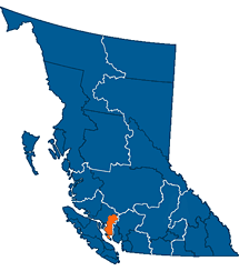
World → North America → Pacific NW → Canada → Sunshine Coast Trail
One of the best hikes in the world
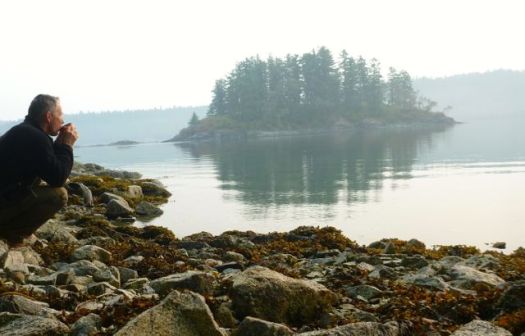
Sunshine Coast Trail
Nearby West Coast Trail is the best hike in the world. Right?
The SCT is the latest of a number of WCT alternatives. And it’s an excellent alternative. Be aware that “Sunshine Coast” is the name of the region. Not much of the SCT is on the coast. It’s almost entirely inland.
Click PLAY or watch an introduction by the founder on YouTube.
Note: You can recommend improvements by leaving recommendations or links in the comments on this page. Our editors will consider them. Thanks for your help!
 AT A GLANCE
- up to 180km (112mi)
- the best jumping off point for the SCT is Powell River, close to Vancouver B.C.
- this is the end of the highway. To get to Alaska from here, jump into Desolation Sound. And start swimming. 😀
- the Sunshine Coast is less rainy than the rest of the lower mainland, but can still be very wet
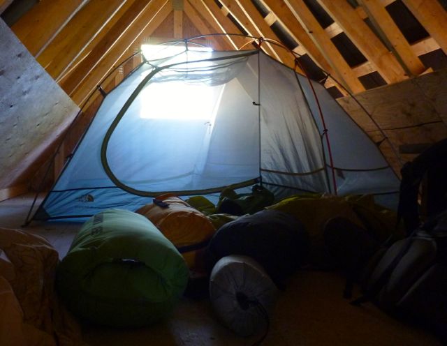
- possible to hike hut to hut without carrying a tent
- 12 huts built since 2009 – “first-come, first-sleep”. Each can accommodate about 12 hikers. Golden Stanley hut was completed early 2016.
- Canada’s longest hut to hut hiking trail
- NO permits or reservation required
- free 🙂
- it’s considered B.C.’s hidden gem of hiking routes. Many have not yet heard of this adventure.
- we recommend you carry a tent as a back-up. There are many scenarios which might cause you not to reach the next hut on any given day.
- you can hike year round, though May – October are the best months

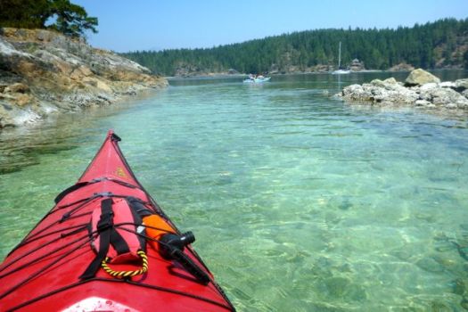
- Powell Forest Canoe Route intersects the SCT. Consider doing some kayaking in conjunction with your hiking trip.
- the Sunshine Coast is very popular with mountain bikers. Some will be sharing your trails.
 Why We Like This Hike
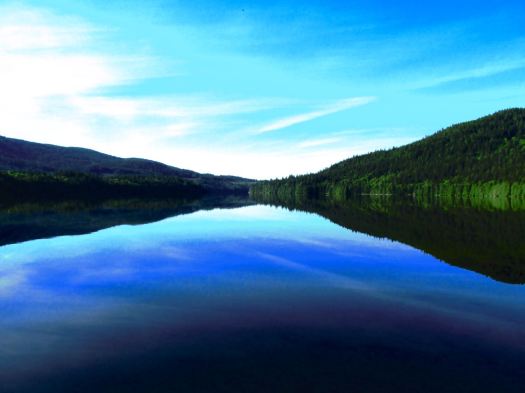
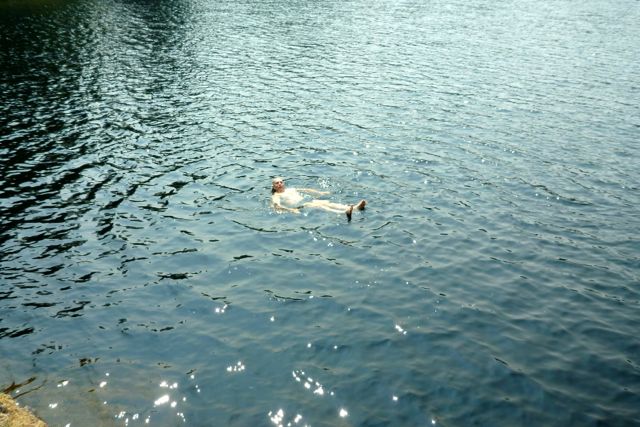
- creeks & lakes, ocean vistas, mountaintops, …
- easy access, easy escape if you have problems
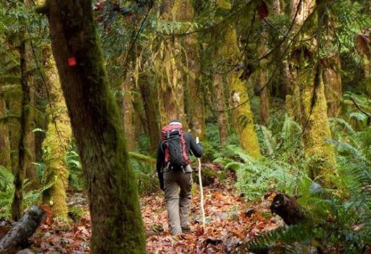
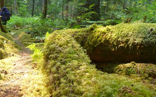
- gorgeous temperate rain forest environs
- an excuse to chow down at Nancy’s Bakery in Lund
- seeing impressive old growth trees
- share the trip with whales, sea lions, mink. Possibly bear or cougar.
- elk, deer, raccoon, coyote
- it’s still being improved, year-by-year
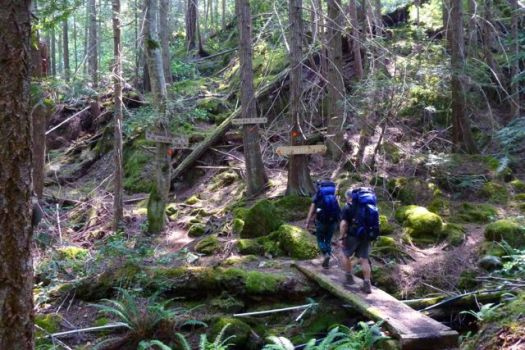
- over 12,000 trail markers, 700 wooden signs
- you may share a lovely lake with nobody else other than the odd loon. True wilderness.
- on the same trip, save some time to kayak nearby Desolation Sound
Launched December 2013, the Sunshine Coast Trail Passport $5 enables hikers to collect unique stamps for each of the huts on the Sunshine Coast Trail that they visit.

- conceived in 1992 by Eagle Walz and friends, the trail is so new that it’s not yet crowded
- volunteer built and managed. A labour of love.
- you see historic relics: donkey engine parts, cables, rusty bed frames, etc.
Considerations
The biggest surprise for our group of 11 in July 2015 was the difficulty of some sections. It’s a new trail. You’ll frequently need to scramble over, under or around fallen logs.
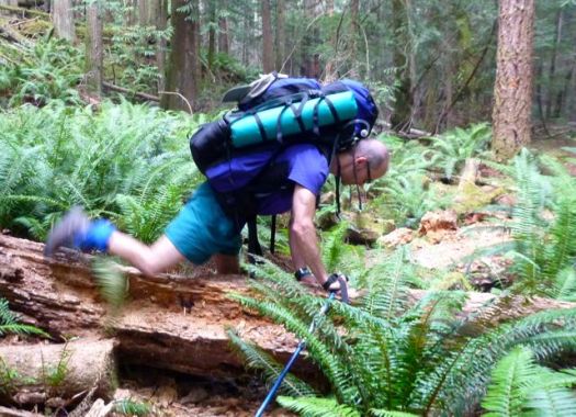
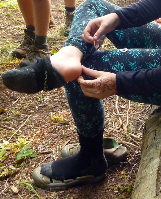
Be sure you have the right footwear for rough and wet conditions. Steep downhills are very hard on the toes. It’s easy to get blistered if your feet get wet.
- some thorns
- many trails are badly overgrown. If you carry a machete, you’ll use it.
- water must be treated. There are long sections with no good sources.
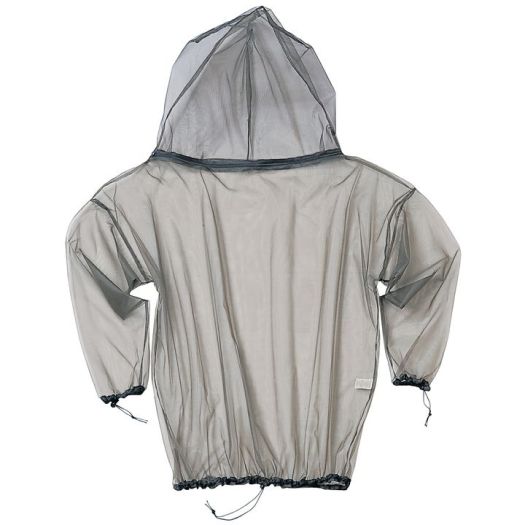
- June and July 2015 were atypically hot. Mosquitoes were a nuisance. Four of 11 hikers were stung by wasps over 3 days, as well.
- May 2016 we wore net clothing. All day long. Black flies and no-see-ems were a pest too.
- mobile phone service is sporadic
- fires are allowed unless a fire ban is in effect
- hypothermia is a real risk if you get wet
- most huts have pit toilets and picnic tables
- bears live here. You’ll see scat for sure.
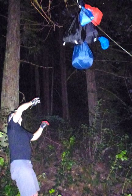
- store your food carefully in the huts. Or hang it carefully.
- the SCT is not (much) protected by Regional nor Provincial parks
- you will see these guys, but they are harmless Garter snakes

- you should be happy to see snakes. They prey on these camp pests.

- the Eagle River crossing is normally very easy
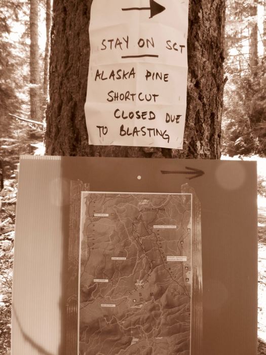
- the SCT gets close to active logging areas.

- you may face detours. Be ready for anything.
- some prefer to do the last 42km backwards, south to north. It’s known as the Troubridge Trudge. You can walk off the ferry at Saltery Bay – and start hiking from the terminal.
Cost
Nearby, the West Coast Trail is the most expensive hike in Canada. You might spend $200 each. By comparison, there are no costs to hike the Sunshine Coast Trail. 🙂
Transportation from Powell River – Lund one way, if needed, is expensive however. A taxi could cost you C$70 or more. The bus runs only a couple of times a week.
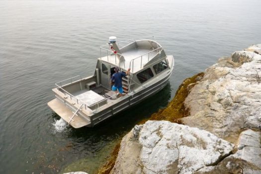
If you choose to hire a water taxi to ferry you from Lund to Sarah Point, check costs on lundwatertaxi.com. It’s quite reasonable for a large group.

Routes
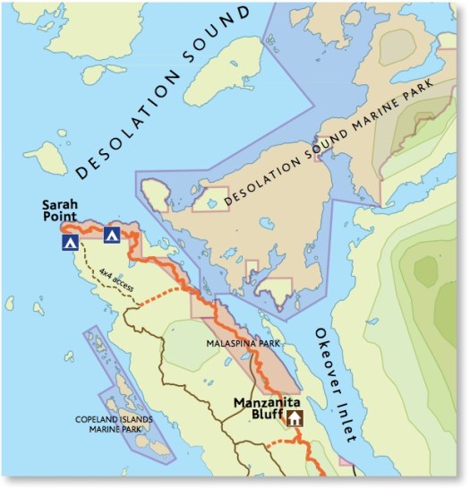
- full distance, so far, is about 180km (112mi)
- Sarah Point in Desolation Sound to Saltery Bay, north to south is the preferred direction
- it’s easy to section hike
- 27 sections are organized into 5 major blocks:
- Sarah Point to Malaspina Road 21.3km
- Malaspina Road to Powell Lake 28.9km
- Powell Lake to Fiddlehead Farm 30.9km
- Fiddlehead Farm to Eagle River 54.6km
- Eagle River to Saltery Bay 42.0km
- many thru hike sections 3 & 4
- a good resupply is Lang Bay General Store near the end of section 4. It’s easy to hitchhike from there. Catch the infrequent bus. Or stay at a nearby campground.
- the official website suggests popular multi-day routes from 2-6 days
- the default plan for this hike would be to start as close to Sarah Point as you wish, then hike as far as you can in the number of days you have available. Decide day-by-day which hut you want to reach, depending on weather, fitness and enthusiasm of your group
- a GPS is useful. The Walz guidebook includes coordinates. Many hikers get lost though you can usually quickly backtrack to regain the trail
- you must decide on alternative trails at various points
There’s a paddling route roughly in parallel with a large section of the Sunshine Coast Trail. From Shinglemill to Canoe Main. Hikers could switch to canoes or kayaks for a break from the trail, or meet up with paddlers at designated campgrounds. Portage is required.

Trekking Guides
We’re not aware of any companies nor guides who lead this hike.
Logistics
- consider taking a bus from Vancouver airport all the way to Powell River. There are a number of public transportation options once you get to the Sunshine Coast.
- this is a seemingly simple hike — you could wait until you get to the Sunshine Coast to pick up the guidebook
- easiest access is by ferry from Vancouver, Canada (40min from Horseshoe Bay) with vehicle or on foot. You cannot drive directly from the mainland.
- from Vancouver Island you can take the ferry from Comox and start the hike same day
- air access by float plane is available, too
 Here are the ferries you may need:
- B.C. ferries – Horseshoe Bay – Langdale
- B.C. ferries – Sechelt – Powell River (Earls Cove-Saltery Bay)
- B.C. ferries – Comox – Powell River (Little River-Westview)
- if you do bring a vehicle, decide where to store it while on the trail. Many opt to pay something like $7 / day to keep it secure at Dave’s Parking in Lund near the northern trailhead. Or arrange to park in a hotel to which you’ll be returning. (Many vehicles are towed in Lund.)
- transportation is required at both ends of the official trail. Many hikers use Lund Water Taxi to get to the start. An alternative is to check in Lund for a vehicle that could drop you on the BC Hydro right-of-way road. From there you can walk (the wrong direction) to the official start.
- recommended –
Upper Deck hostel(now closed) in Sechelt and Harbour Guesthouse, Powell River. We stayed at Willingdon Beach Campsite in Powell River, as well.
Local Information
Powell River Parks & Wilderness Society
Powell River
Telephone: toll free @ 1-877-817-8669, or locally @ 604-485-4701
Email: info@discoverpowellriver.com
- official Sunshine Coast Trail website
- Powell River Visitor’s Centre
 Best Trekking Guidebooks
- Sunshine Coast Trail (4th edition) by Eagle Walz
- A Dream of Giants by Emma Levez Larocque
- Facebook – A Dream of Giants: the story of the Sunshine Coast Trail
- Coastal Hikes by Philip Stone 2007 includes the SCT
We used the Walz guidebook in 2016. It’s good. But not up front in detailing some of the challenges. For example, there’s no mention that the drop-off by boat at Sarah Point is a steep, slippery and dangerous scramble. 😦
A bigger problem with Walz is the format of the guidebook. It’s described as a series of day hikes — very confusing for the thru hiker. What we really need is a dedicated thru hiking PDF guide online. Something that can be downloaded to your phone or tablet.
Be sure to read some current trip reports before you go. This trail is evolving rapidly.
Best Travel Guidebooks
- Lonely Planet – British Columbia & the Canadian Rockies 2011
Best Maps
Best Web Pages
- official website – sunshinecoast-trail.com
- 10 amazing sights awaiting hikers on the Sunshine Coast Trail in B.C.
- trip advisor
- Victoria Club Tread
- CanadaTrails.ca
- Powell Forest Canoe Route – map
- Mitchell’s in Powell River rents canoes and kayaks
- donate to the Sunshine Coast Trail
- become a PR PAWS member (Powell River Parks and Wilderness Society)
Best Trip Reports
- Cora Skaien – June 20 to July 1, 2013
- besthike editor Rick McCharles – Mowat Bay to Lois Main May 2016
- Maniak – Sarah Point to Lund, April 2013
- rustysheep – Sarah Point to Powell Lake, Oct 2010
- Simon Salty Peterson – on prezi (a graphic way to post a trip report)
- besthike editor Rick McCharles – Sarah to Manzanita July 2015
Movies
Chris Bratseth & Jarrod Smith ran a Half Marathon distance August 2014. They give us a good look at the terrain.
Click PLAY or watch it on YouTube.
Click PLAY or watch the XS-NRG Documentary trailer on YouTube. Four runners attempted the 180km SCT non-stop.
Here’s the full movie. (45min)
Questions? Suggestions? Leave a REPLY on this page. Our editors will reply.

To be honest, this is not a COASTAL trail, this is a FOREST trail. Made a 5 days trek this summer, only seen the ocean twice. Most of the time you are under the three. Some people might still like it but better be warn. Lakes, on the other hand, offer some nice camping spot.
You must do the Nootka trail and add to your list. History, remoteness, wildlife and scenery. A must.
Thanks Pierre. Nootka is fantastic.
Hello there! I am hoping to thru-hike this trail this summer, and have a couple of questions for which I’m struggling to find answers:
First – do you happen to have a recommendations on a few good exit points along the trail to easily access a town (without a car) to resupply on food? The guidebook notes trail-road intersections, but it doesn’t say whether there’s a town at the end of the road, how long of a walk it would be to get there, and whether there would be a store there…. Without this info, it’s hard to identify potential resupply points – and accurately plan how many days of food to carry. Any info on this would be so helpful.
Second – do you happen to know how to get back to the car – if it is parked in Lund or Powell River – from Saltery Bay at the end of the trail? This is another question I’ve been having a hard time answering so any info would be great :).
Thank you for your help!
Hey Sig.
The most difficult logistics are getting to Sarah Point. Last year we drove to Lund and hired the water taxi.
Our plan was to walk to and resupply in Powell River. (Due to heat and bugs we decided to WALK out to Lund instead. Very easy.)
http://sunshinecoast-trail.com/plan-your-hike/maps/
Load up in Powell River with LOTS of food. Enough to make it to Dixon Road. At the intersection of Dixon Road and the Sunshine Coast highway is LangBay store. (2365 Lang Bay Rd, Powell River, BC V8A 5C1)
No doubt there are small shops and campground shops along the way. But – just in case – we’d carry enough food.
From Dixon Road we’d (somehow) resupply for the Trudge to the finish.
Hope this helps.
P.S.
There are buses along the main highway. It would be fairly easy to hitchhike, as well.
Thank you so so much!!! This is exactly the info I have been looking for – it will help me prepare :). All the best!
Sig.
Hi there!
Your site is great as it includes some great detailed information – thank you! I am planning to hike a section of the SCT over four days this July with a friend – Fiddlehead Landing to Lang Bay (via Tin Hat Mountain, Elk Lake and Walt Hill). I recently purchased Eagle Waltz’s Hut-to-Hut Hiking Guide which is very detailed but, as you mentioned in your post, “it’s described as a series of day hikes — very confusing for the thru hiker”. Do you have any suggestions on maps, etc that would better prepare us for our hike?
Thanks in advance!
Tanya
Check with the gear shops when you get to town. Perhaps local “hiking” maps have the main SCT routes. You could use the Waltz guide as backup.
Thanks for the suggestion.
Hey guys,
I’m planning to thru hike this trail this summer in 10-12 days. Has anyone done it in this time frame and if so do you have a day to day hiking plan? I’ve been trying to find rough plans for the thru hike to use as a reference and have had a hard time finding something. There’s quite a few multi day hikes that I’ve been piecing together but was hoping for a thru hike plan to reference off of. If anyone has anything that you could offer it would be much appreciated. Thanks for your time!
Jacquie
Hi Jacquie,
Did you do the thru-hike this summer? How’d it go? Any references you found that were helpful?
I’m thinking about it for next summer.
Jeff
I did do the entire trail. I didn’t find anything that showed anyone doing the full trail. I just decided to hut to hut hike and I did. I didn’t realize that a new hut “the golden Stanley” was being built at 145km otherwise I would have completed the entire trail without using my tent. Instead I camped at elephant lake for one night. It’s totally doable to only go hut to hut. Bring a tent in case the huts are full. I ran into 37 people total in the entire 178km so I’m sure you won’t have a problem squeezing into a hut. The trail is amazingly well marked and super easy to follow. Easily the best hike I’ve ever done. I resupplied in Powell River and again in Lang bay. You can leave a box of supplies at the Shingle Mill pub in Powell River and the guy that owns the Lang Bay store charges $5 a day to leave your car there. Hope this helps. Let me know if you have any other questions. Hope you have a blast, I totally did!
Congratulations on completing the thru-hike. Glad to hear the hut-to-hut system works, and that the trail is well marked. I am sure I will think of more questions over the winter, but for the moment – how did you manage transportation logistics? Did you leave your car in Lang Bay and take a bus or shuttle to Lund/Sarah Point? (and then again from Saltery Bay to Lang Bay at the end?) Or did you have more than one car? How long did the entire hike take?
Thanks – Jeff
Thanks so much Jeff and Jacquie! Im in your same predicament right now Jacquie and this thread is the only info on thru-hiking that I can find. Sct 2018 here we go!
Looking to just go up to Tinhat Hut for one night in January or February. Is this doable at that time of year? Thank you.
Indeed! What an amazing trail. The fact that volunteers have built and maintain these trails is so incredible. Did about 1/3 of the trail, and will def be back for the rest of it ❤
Super helpful article!! Thanks!