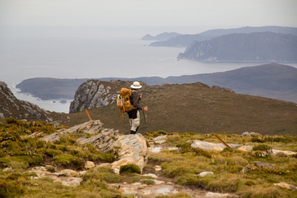
The South Coast Track is a challenging walk in a region of Tasmania exposed to harsh weather conditions. There are no huts along the track. Track conditions are often difficult. Walkers must be fully self-sufficient, well-equipped and experienced.
Note: This page is a stub. Suggest improvements by leaving recommendations or links in the comments on this page. Our editors will consider them. Thanks for your help!
hard core bush walkers should consider adding on the Port Davey Track, an extra 3-5 days
do Tasmania’s fantastic Overland Track on the same trip to Tasmania
no booking required
no quotas on numbers of bushwalkers
chance to see some of the weird and wonderful Aussie wildlife
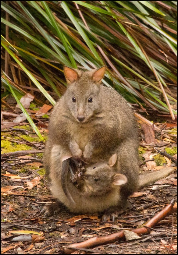
Padelmelon with Joey
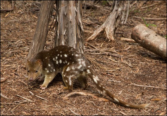
Spotted-Tail Quoll
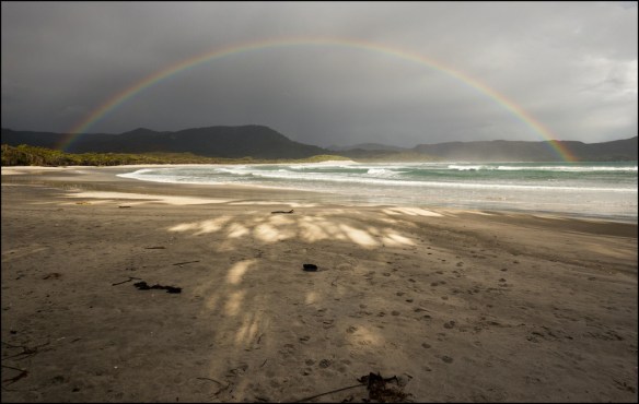
though it’s a famed coastal hike, long sections leave the sea. This adventure offers a lot of variety.
Considerations
no roads to Melaleuca, so walkers must either fly, sail or walk in-and-out
Melalueca is an airstrip with some huts
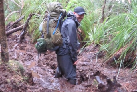
many impassable headlands force the trail inland
traverses two mountain ranges. Steep, muddy climbs.
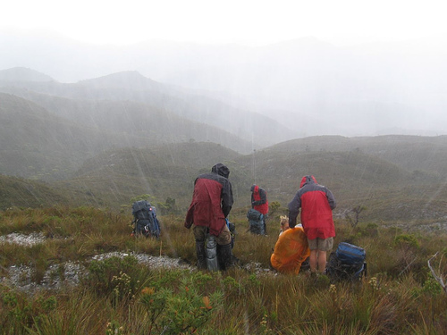
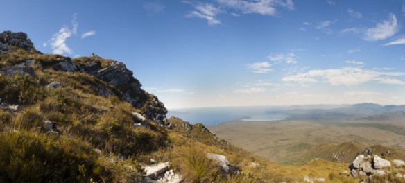
long sections of open plains
many streams to cross. No bridges. In case of flood, wait until the water goes down to about knee deep on the crossing.
rough and muddy over extended sections
rough and muddy is no exaggeration. We nearly lost a hiking boot in a mud hole on our one adventure on the SCT
be prepared for cold wind and heavy rain any day of the year
hail
walking in winter and alone is definitely not advised
fuel stoves only
there are pit toilets at every major campsite. You might not want to use them. 😕
bushes and bogs, fallen trees and hidden tripping hazards
treat all H20, just to be safe
much of the drinking water is tannin stained. Safe, but sketchy looking.
Tasmania is latitude 40°S, directly in the path of the “Roaring Forties” winds. Hikers have turned back due to wind.
pack for cold, wet, miserable weather
hypothermia is a real danger
store your food securely or animals — especially possums — may chew holes in your tent. Mice and the like may get into your food.
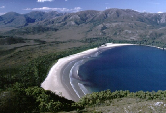
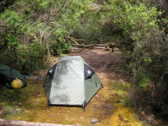
Louisa Bay campsite
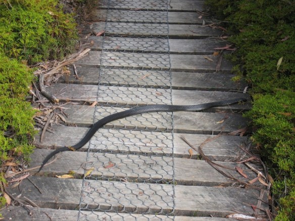
you might see snakes sunning on the trail. Wear sturdy boots and thick gaiters if this worries you. Surprisingly, not many hikers are bitten. All Tassie snakes are venomous.
Par Avion ph (03) 6248 5390 is the company most use to fly in to Melaleuca. Contact them for prices. In 2015 Hobart – Melaleuca was A$260 per person (group discount available for 7 or more passengers).
Par Avion won’t transport your stove fuel by plane. Instead you must purchase fuel from them at Melaleuca. Bring your own (empty) fuel container. They offer canisters, methylated spirit & Shellite.
If you’d rather take a boat than fly, ask Par Avion. They also coordinate sea transfers to and from Melaleuca.
ROUTES
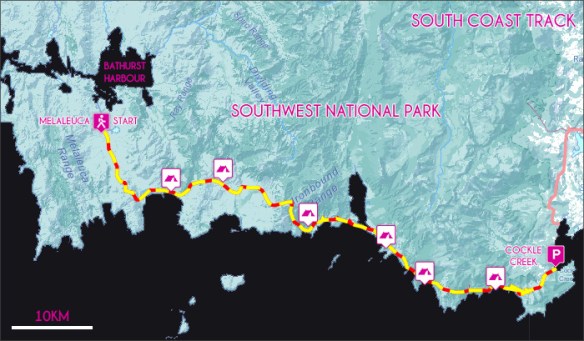
Traditional route is a fly-in to the isolated locality of Melaleuca. Then walk out to Cockle Creek south of Hobart.
Walking the other direction risks you getting trapped in Melaleuca without food in poor weather.
Yet another option is to have Par Avion air drop your re-supply at Melaleuca. You could hike in. Pick up your food package. Then hike back out.
There are no huts so you’ll be camping each night. But here’s one itinerary recommended by Aussie hiking guru John Chapman:
1
Melaleuca airstrip to Point Eric at Cox Bight, 13km, 4 hours
2
To Louisa River, 17km, 6 hours
3
To Deadmans Bay over the Ironbound Range, 12km, 8 hours
4
To Prion Beach boat Crossing, 9km, 4 hours
5
To Granite Beach, 12km, 5 hours
6
To South Cape Rivulet, 9km, 6 hours
7
To Cockle Creek, 12km, 3.5 hours
Exiting at Cockle Creek you have some shuttle options for getting back to Hobart: